Late winter snow hammers U.S. northeast, icy conditions ahead

A worker cuts away a tree that fell across Riverside Drive during a snow storm in upper Manhattan in New York City, New York, March 4, 2019. REUTERS/Mike Segar

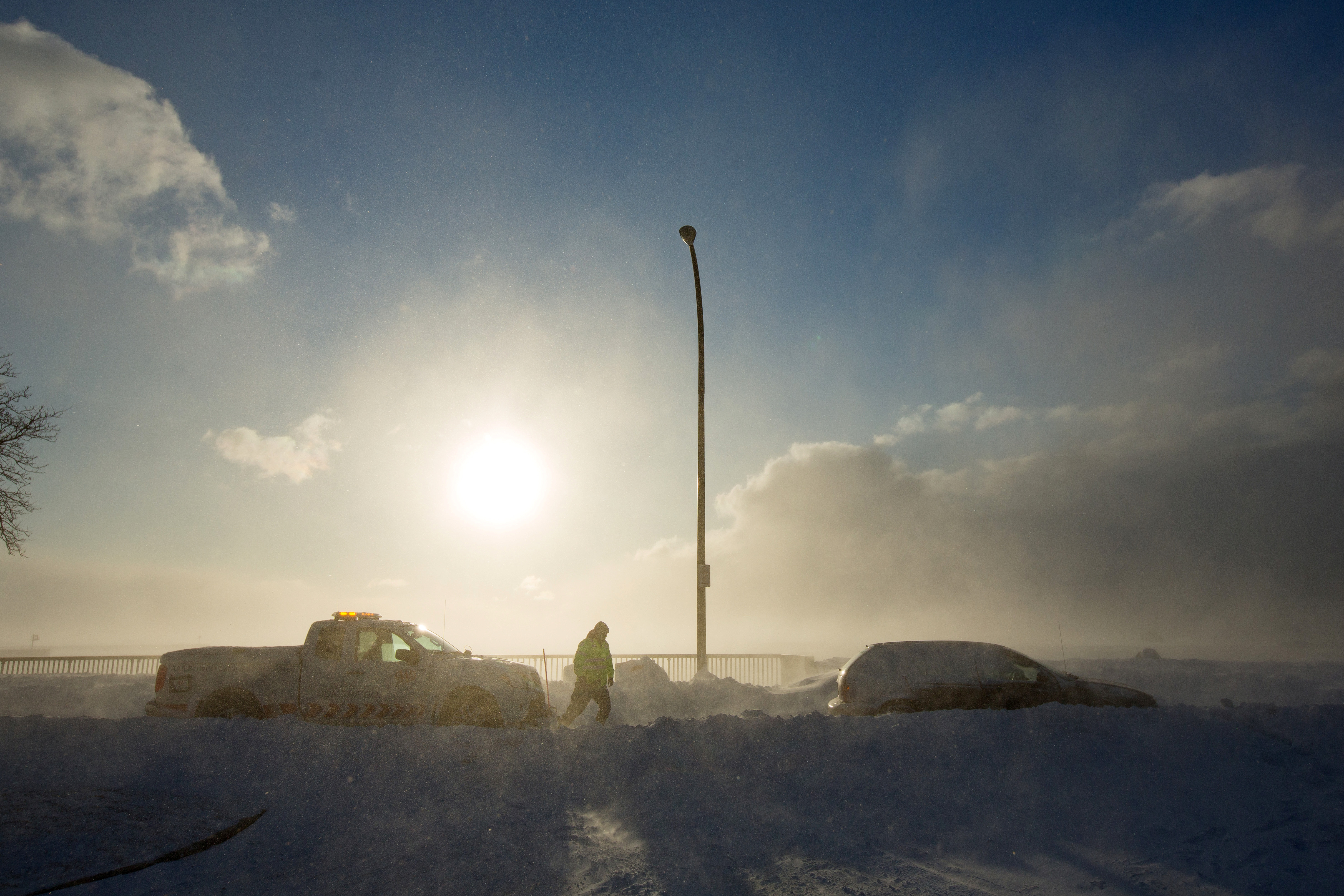
NEW YORK (Reuters) – New York faced its biggest snowstorm of the winter on Monday as snow spread across the northeastern United States, infuriating commuters who juggled canceled planes and trains and faced icy travels ahead as temperatures plunge.

A band of winter weather stretching from Maryland to Maine dumped 15 inches (38 cm) of snow overnight on downtown Boston and 5 inches (13 cm) on New York’s Central Park, said meteorologist Marc Chenard of the National Weather Service.

A woman makes her way through the snow on cross country skis during a winter storm in Pallisades, New York March 4, 2019. REUTERS/Mike Segar

A woman makes her way through the snow on cross country skis during a winter storm in Pallisades, New York March 4, 2019. REUTERS/Mike Segar

That was enough for New York Mayor Bill de Blasio to take the rare step of shutting the nation’s largest public school system and for New Jersey Transit, the largest statewide public transportation system in the United States, to cancel about a dozen commuter trains.

“This is horrible!” said Steve Wesley, 56, as he shoveled snow from his driveway in Maplewood, New Jersey, a New York City suburb.

Wesley’s two-mile local commute by car was delayed nearly two hours by the four to six inches of snow. 

“This is not what I want to be doing,” said Wesley, a sales representative for a power equipment distributor. “I’m usually the first one into the office. And if I get there and the parking lot is not plowed, I’ll be shoveling that too.”

Nearly 1,000 U.S. flights were canceled, most at Boston Logan International and New York area airports, according to FlightAware.com.

Government offices and libraries in Boston were closed. In New Jersey, where Governor Phil Murphy declared a state of emergency ahead of the storm, state workers had a two-hour delay.

Commuting challenges may mount over the remainder of the work week as snows melt and then temperatures drop, icing over roadways.

“Each day is a little bit cooler,” said Chenard, noting the week’s highest temperatures for the Northeast will be in the low 30s. “You’ll get some melting during the day, especially when the sun is hitting the snow, and then at night, it’s going to be cold enough to refreeze. Any road surfaces that aren’t treated certainly could get icy at night into the morning.”

(Reporting by Barbara Goldberg; Editing by Scott Malone and Steve Orlofsky)

Schools shut, flights canceled as storm sweeps U.S. Midwest, East Coast

A local resident removes snow from a car during a winter storm in Washington, U.S., February 20, 2019. REUTERS/Carlos Barria

(Reuters) – A winter storm swept across much of the U.S. Midwest and East Coast on Wednesday, hampering air travel and prompting officials to close federal offices in Washington and several large public school systems.

The National Weather Service warned the storm could make travel very difficult, with snow, sleet and freezing rain potentially causing downed branches and power outages.

The storm reached from northern Minnesota down through Missouri and east into the Mid-Atlantic region and could bring as much as 6 inches (15 cm) of snow along with sleet and freezing rain, the National Weather Service said in an advisory.

The storm forced the closing of federal agencies in Washington as well as schools in Philadelphia, Baltimore and Washington.

Hundreds of flights were delayed or canceled in and out of major airports in Washington, Philadelphia and Chicago, according to Flightaware.com. Airports told passengers on social media to check their airlines for delays and cancellations.

(Reporting by Brendan O’Brien in Milwaukee; Editing by Jeffrey Benkoe)

Pineapple Express’s biggest punch set to hit water-logged California

The aftermath of turbulence is seen on Compass Flight 5763 to Seattle, February 13, 2019 in this still picture obtained from social media video by Reuters February 14, 2019. JOE JUSTICE, SCRUM INC./via REUTERS

(Reuters) – The worst of the rain, snow, and winds carried by the so-called Pineapple Express, a river of warm air loaded with moisture, will hit California on Thursday and stick around at least through Friday, forecasters said.

The weather system, headed east from near Hawaii, is the wettest storm on the U.S. West Coast this season. It has swamped cars, flooded vineyards and forced hundreds of Californians to evacuate their homes Wednesday to escape the threat of mudslides.

Three Delta Air Lines passengers suffered minor injuries when severe turbulence shook a flight headed from southern California to Seattle on Wednesday, according to authorities.

The plane, a Embraer 175 aircraft operated by Compass Airlines under contract with Delta, was forced to land in Reno, Nevada, Compass said in a statement.

“We did a nose dive twice,” a passenger wrote on Twitter, according to the newspaper.

“That whole area from Southern California and on up to Washington is primed for severe turbulence at altitude, especially over the mountains” said David Roth, a forecaster with the National Weather Service’s Weather Prediction Center in College Park, Maryland.

Roth said risks for motorists will be highest during Thursday’s morning commute. Some mountain areas in southern and central California will get up to an inch of rain an hour for at least three hours, with the rain continuing throughout the day.

“It will be the most dangerous in areas where there were wildfires,” he said. “The ground is already saturated with water and there’s not much vegetation left to hold the soil.”

Some areas around Los Angeles could see more than five inches (13 cm) of rain from the storm, which is being channeled to the coast by the flow of atmospheric moisture.

Residents of Lake Elsinore, 56 miles (90 km) east of Los Angeles, got mandatory evacuation orders because nearby hillsides, scorched by fire in 2018, might turn into rivers of mud and debris.

Among the hardest-hit areas was northern California, where rain driven by winds up to 75 miles per hour (120 km per hour) pounding parts of Sonoma County’s wine country.

The NWS also expects more than eight feet (2.4 meters) of snow in some areas of the Sierra Nevada mountains. The Pineapple Express is one of a string of storms that have swelled snowfall in California to above-average levels, delighting farmers and skiers following years of drought.

(Reporting by Rich McKay; Additional reporting by Andrew Hay and Tracy Rucinski; Editing by David Gregorio)

‘Pineapple Express’ storm douses California with rain, snow

Snow capped mountains are seen behind the downtown Los Angeles skyline, California, U.S., February 12, 2019. REUTERS/Lucy Nicholson

By Andrew Hay

(Reuters) – A Pacific storm system known as the “Pineapple Express” threatened to dump up to 8 inches of rain and 8 feet of snow on areas of California, raising risks of flooding and mudslides, meteorologists said on Wednesday.

“The (Pineapple) Express is no joke,” said Bob Oravec, meteorologist with the National Weather Service’s Weather Prediction Center in College Park, Maryland of the strongest weather system of the season.

The weather system, also known as an atmospheric river, gets its name from the flow of moisture that periodically heads east from waters adjacent to the Hawaiian Islands to soak the U.S. West Coast. It blanketed parts of Hawaii with snow over the weekend and is expected to drench California.

The San Francisco Bay area could be hit by flash flooding and falling trees as saturated ground gets up to 8 inches more rain and strong winds blow in, the weather service said.

“We’re talking 3 to 5 inches of rain in San Francisco and coastal areas in just the next 24 hours, and more on into Friday,” Oravec said.

To the northeast in the Sierra Nevada Mountains, passes could see between 80 and 100 inches (approximately 7 to 8 feet) of snow through Friday.

Valley areas face flood watches over fears the relatively warm Pineapple Express system could initially drench areas as high as Lake Tahoe with rain, melting snow and swelling rivers.

WILDFIRE BURN AREAS

The Central and Southern California coast can expect flash flooding and possible mudslides near recent wildfire burn areas, the NWS reported.

Oravec said that the problem is not just the amount of rain, but the fact that it will hit in a short amount of time.

“It’s going to be heavy and fast,” he said. “Debris flows and mudslides are a risk in any area scorched by the wildfires. There’s little to no vegetation to slow that water down.”

Up to 2 inches of rain was expected in the Los Angeles area between Tuesday evening and Thursday morning, the weather service said.

A string of winter storms has swelled snowpack in California to above-average levels, delighting farmers in need of water and skiers in search of powder.

(Reporting by Andrew Hay, additional reporting by Rich McKay, editing by Louise Heavens)

Widening snowstorm, freezing rain to snarl travel in eastern U.S.

Pedestrians walk down the sidewalk as snow falls in the Times Square neighborhood of New York, U.S., February 12, 2019. REUTERS/Lucas Jackson

NEW YORK (Reuters) – A widening snowstorm with an encore of freezing rain iced over the U.S. Midwest on Tuesday and headed east, causing hundreds of flight cancellations and closing schools, and was expected to tangle New York and Boston’s evening rush hour.

As much as 1 foot (30 cm) of snow was predicted for inland parts of New England, as well as up to 4 inches (10 cm) in New York City and up to 5 inches (13 cm) in Boston before turning to freezing rain in the late afternoon, said meteorologist Dan Petersen with the National Weather Service in College Park, Maryland.

“The big cities along the coast are going to have a pretty quick changeover from snow to sleet and freezing rain and eventually rain,” Petersen said in a phone interview. “The danger of snow changing to freezing rain is people slip and slide quite a bit and that’s the cause of accidents when people lose control of their cars.”

The storm by early morning had iced over Illinois and Michigan and was moving through Wisconsin into northern Pennsylvania and southwestern New York state. The widening storm was expected to reach as far south as northern Delaware and Maryland, Petersen said.

More than 1,600 flights into and out of the United States were canceled on Tuesday, most of them at airports in Chicago, New York and Boston, according to FlightAware.com.

Ahead of the storm, New Jersey Governor Phil Murphy declared a state of emergency, and hundreds of schools were closed for the day.

(Reporting by Barbara Goldberg; editing by Jonathan Oatis)

Icy blast begins to ease in U.S. Midwest, Northeast

A worker from AAA aids vehicle trapped in snow during the polar vortex in Buffalo, New York, U.S., January 31, 2019. REUTERS/Lindsay DeDario

By Michael Hirtzer and Gina Cherelus

CHICAGO/NEW YORK (Reuters) – Frigid weather that paralyzed a large swath of the United States this week and caused at least 21 deaths began easing on Friday as an Arctic air mass pulled away, setting the stage for a warmer weekend in the Midwest and the Northeast.

Temperatures from southern New England to the Upper Midwest should reach the mid-40s to low 50s Fahrenheit through the weekend and Monday, forecasters said, after a record-breaking cold snap that stopped mail deliveries in some parts of the Midwest and shuttered schools and businesses.

In Chicago, which experienced temperatures as low as minus 22F (minus 30 Celsius) earlier this week, temperatures of 19F (-7C) on Friday morning felt positively balmy as a measure of normalcy returned to the nation’s third-largest city.

“It feels like summer,” said Dolores Marek, 57, as she got off her commuter train in Chicago wearing a long parka coat as set out on the 1.5 mile-(2.4 km) walk to the local college where she works. “This is much better than it was.”

Meteorologists linked the spell of brutal cold to the so-called polar vortex, a cap of icy air that usually swirls over the North Pole. Changing air currents caused it to slip down through Canada and into the U.S. Midwest this week.

Bryan Jackson, a National Weather Service meteorologist, said the core of the vortex was pulling north into eastern Canada, though residual icy air was still pushing over to the U.S. Northeast.

Temperatures on Friday morning ranged from below zero Fahrenheit to the teens in parts of New York, Pennsylvania, Massachusetts and New Jersey. The Washington D.C. area, which had 20F (minus 7C) temperatures, was under a winter weather advisory until the afternoon as around one inch (2.5 cm) of snowfall accumulated during the morning.

“That cold air that was over the Great Lakes, over the Midwest, has shifted off. Now the high pressure is over Pennsylvania and New York,” Jackson said in a phone interview. “As it moves east, it’ll bring in air from the south and we do expect it to warm up over the weekend.”

Rachel Liao, 29, a student at the New School in New York, said she wished classes had been canceled due to the cold.

A woman takes a selfie in front of a mostly frozen Bryant Park fountain, as record low temperatures spread across the Midwest and Eastern states, in New York City, U.S., January 31, 2019. REUTERS/Brendan McDermid

A woman takes a selfie in front of a mostly frozen Bryant Park fountain, as record low temperatures spread across the Midwest and Eastern states, in New York City, U.S., January 31, 2019. REUTERS/Brendan McDermid

“I just want to stay inside,” Liao, a New York native, said. “I’m not used to this.”

Temperatures in the Upper Midwest, including Illinois, Indiana and Ohio, will reach well above zero F (minus 18C) on Friday, with highs making it into the teens and low 20s.

Even so, parts of Minnesota, Wisconsin, Michigan and Iowa were still experiencing temperatures in the negative single digits, Jackson said.

The lowest temperature recorded early Friday morning was minus 34F (minus 37C) in Stonington, Michigan, according to the National Weather Service.

By Saturday, highs will be in the 30s and even low 40s in the Midwest. The central Plains will be in the low 60s, nearly 20 to 25 degrees above normal, the weather service said.

More than 40 cold-temperature records were broken on Thursday, the coldest morning since the polar vortex moved in late on Tuesday. The mass of Arctic air had clung to a swath of the United States from Iowa and the Dakotas across the Great Lakes region and into Maine for days.

Officials across multiple states linked at least 20 deaths to the deep freeze. The death toll rose after at least nine more people in Chicago were reported to have died from cold-related injuries, according to Stathis Poulakidas, a doctor at the city’s John H. Stroger Jr. Hospital.

Amtrak train services that had been halted since Wednesday in Chicago’s hub resumed on Friday, as did U.S. postal service that was halted or limited in six Midwest states.

Thousands of flights were canceled and delayed earlier in the week, mostly out of Chicago, but on Friday the flight-tracking site FlightAware reported cancellations in the United States down to more than 400.

(Reporting by Rich McKay in Atlanta and Gina Cherelus in New York; Additional reporting by Peter Szekely and Gabriella Borter in New York and Michael Hirtzer in Chicago; Editing by Larry King, Jonathan Oatis and Frances Kerry)

‘Life-and-death’ cold grips eastern, Midwest United States

FILE PHOTO: The U.S. Capitol is seen behind a snow pile in Washington, U.S., January 16, 2019. REUTERS/Yuri Gripas/File Photo

By Rich McKay

(Reuters) – Winter winds brought extreme cold and ice-slicked roads to the Midwestern and Eastern United States on Monday, with the U.S. Martin Luther King Jr. Day holiday and an ongoing government shutdown allowing many to heed official advice to stay indoors.

The arctic blast of frigid air has followed a January storm that dumped more than a foot (30 cm) of snow and sleet across the Northeast, which started melting Sunday.

Pedestrians walk in the rainy day at Time Square in the Manhattan borough of New York City, New York, U.S., January 20, 2019.REUTERS/Jeenah Moon

Pedestrians walk in the rainy day at Time Square in the Manhattan borough of New York City, New York, U.S., January 20, 2019.REUTERS/Jeenah Moon

Temperatures fell to single-digits Fahrenheit (about -20 C) from New York City to Boston and through northern New England and froze melting snow late on Sunday and early Monday, said Marc Chenard at the National Weather Service’s Weather Prediction Center in College Park, Maryland. Winds up to 30 to 40 miles per hour (48-64 kph) added possibly deadly wind chill.

“This is definitely dangerous, life-and-death kind of weather happening,” Chenard said. “Minnesota and Wisconsin will see temperatures in the negative 20s.”

“Boston will be just 3 degrees (Fahrenheit) this morning, with wind chills of minus 12 or more,” he said. “New York City and D.C. will be in that same range, maybe hitting the teens later today. It’ll be record or near-record cold.”

The NWS issued wind-chill advisories and warnings for more than 10 states, from North Dakota and to East Coast metropolitan centers.

High temperatures for Monday are forecast at 17 Fahrenheit (minus 8 Celsius) for New York City and 12 F (minus 11 C) for Boston.

Many Americans had the day off work on Monday, either because of the holiday or because they are among the furloughed federal government workers who find themselves in the longest shutdown in U.S. history, caused by an impasse over funding U.S. President Donald Trump’s plans to build more barriers on the U.S.-Mexico border. [nL1N1ZK05R]

More than 6,000 flights were delayed, mostly in New York and New England, according to FlightAware.com, down from more than 14,000 on Sunday. More than 500 flights were canceled early Monday compared with more than 2,000 Sunday, the website reported.

Tuesday’s weather will be only slightly warmer, Chenard said, with temperatures reaching the low 20s Fahrenheit in the Northeast. By Wednesday, some areas such as Boston will be in the high 30s or low 40s. Washington D.C. temperatures might reach 50 degrees, he said.

But the relatively warmer temperatures won’t last. Another arctic blast is on its way in time for next weekend.

(Reporting by Rich McKay in Atlanta, additional reporting by Jonathan Allen in New York; Editing by Scott Malone and Nick Zieminski)

Worst is over for winter storm that clobbered U.S. Midwest, D.C. and New England

Visitors make their way through snow left by Winter Storm Gia, which paralyzed much of the nation's midsection, at the Lincoln Memorial in Washington, D.C., U.S., January 13, 2019. REUTERS/Mike Theiler

By Rich McKay

(Reuters) – The deadly winter storm that clobbered a swath of the U.S. Midwest and East Coast over the weekend is blowing out to sea but leaves as much as 13 inches of snow in Washington, D.C. and Virginia, and frigid arctic air parked over New England.

All Washington D.C. federal offices would be closed on Monday, but train and bus service in the metro D.C. area would resume after being shut down on Sunday, officials said.

“There’s some digging out to do,” Jim Hayes, a forecaster with the National Weather Service’s Weather Prediction Center in College Park, Maryland, said early Monday.

“In Virginia, D.C. and Maryland, 6-to-12 inches of snow fell with some places getting 13 inches,” he said.

The good news is that around noon on Monday the clouds should start clearing and temperatures will rise into the low 40’s Fahrenheit, Hayes said.

The snowstorm is blamed for the deaths of at least eight people in road accidents across the U.S. Midwest and possibly also the death of an Illinois state police officer who was killed on Saturday during a traffic stop, officials said.

Air traffic at Ronald Reagan National Airport and Dulles International Airport was returning to normal. Early on Monday, fewer than 400 flights were canceled in affected areas and about 1,600 were delayed, according the online flight tracking site FlightAware.

At the height of the storm, more than 1,600 flights were canceled in and out of U.S. airports on Sunday, the bulk of them at Washington’s Reagan and Dulles, the website reported.

Winter storm warnings for millions of Americans in 10 states and Washington, D.C., were being lifted early Monday in a swath of the United States from Colorado to the East Coast, Hayes said.

“But up north it’s going to stay cold,” Hayes said.

Boston temperatures will creep up from the teens (Fahrenheit) into the low 20s. Temperatures in Portland, Maine will top-out at 11 degrees Fahrenheit (minus 12 Celsius) as a core of Arctic air stays parked over New England, Hayes said.

“The worst is in Big Black River, Maine,” said Hayes. “It hit minus 20 (minus 29 Celsius) overnight.”

(Reporting by Rich McKay in Atlanta; Editing by Peter Graff)

Heavy snow hammers U.S. Midwest after holiday weekend

A driver clears the snow off his car during an early season snowfall in the Boston suburb of Medford, Massachusetts, U.S., November 15, 2018. REUTERS/Brian Snyder

(Reuters) – Commuters in Chicago and across the Midwest faced inches of heavy, wet snow as they headed back to work on Monday after the long Thanksgiving holiday weekend, with the storm knocking out power, icing roads and canceling some flights.

The National Weather Service ended blizzard warnings early on Monday in northeast Missouri through the Chicago metropolitan area and northeast into Michigan, but noted strong winds of up to 45 miles per hour (72 kph) would continue to blow around drifts of the snow accumulated overnight.

“Snow will continue to taper off to flurries and then end this morning,” the service’s Chicago office said in a statement, warning drivers to take extra caution on slippery roads in low visibility.

“The drive into work was NASTY,” Diane Pathieu, an ABC7 Chicago news anchor, wrote on Twitter of her pre-dawn commute. “Roads barely plowed, wind blowing snow everywhere. Proceed with caution!”

North of Chicago, the city of Evanston’s police department said in a statement its power had been knocked out by the storm, although it was still able to receive 911 calls.

Dozens of school districts in Illinois, Missouri, Iowa and Kansas canceled classes due to the weather. Chicago public schools were expected to open.

The storm canceled 1,270 flights on Sunday, a busy day for travelers trying to get home after the Thanksgiving weekend.

That included about 900 flights to and from Chicago O’Hare International Airport and Chicago Midway Airport and almost 200 flights at Kansas City International Airport.

On Monday morning, about 500 flights to and from O’Hare had been canceled, about 17 percent of all scheduled flights, according to the FlightAware flight tracking service.

(Reporting by Brendan O’Brien in Milwaukee and Jonathan Allen in New York; Editing by Sunil Nair, Louise Heavens and Frances Kerry)

Expected rains could hinder search for California wildfire victims

Lidia Steineman, who lost her home, prays during a vigil for the lives and community lost to the Camp Fire at the First Christian Church of Chico in Chico, California, November 18, 2018. Noah Berger/Pool via REUTERS

By Jonathan Allen and Nick Carey

(Reuters) – Heavy rains are expected in northern California on Tuesday, raising the risk of mudslides and hindering the search for more victims of the deadliest wildfire in the state’s history as nearly 1,000 people remain listed as missing.

Remains of 79 victims have been recovered since the Camp Fire erupted on Nov. 8 and largely obliterated the Sierra foothills town of Paradise, a community of nearly 27,000 people about 175 miles (280 km) north of San Francisco.

The missing persons list kept by the Butte County Sheriff’s Office still has 993 names on it. That number has fluctuated dramatically over the past week as additional people were reported missing, or as some initially listed as unaccounted for either turn up alive or are identified among the dead.

Sheriff Kory Honea has said some people have been added to the list more than once at times under variant spellings of their names.

As of Monday, the fire has torched more than 151,000 acres (61,100 hectares) of parched scrub and trees, incinerating about 12,000 homes along the way, Cal Fire said.

Containment lines have been built around 70 percent of its perimeter, according to the agency.

Efforts to further suppress the flames were likely to benefit from a storm expected to dump as much as 4 inches (10 cm) of rain north of San Francisco between late Tuesday and Friday, said Patrick Burke, a National Weather Service forecaster.

‘MUDDY, MUSHY MESS’

But heavy showers risk setting off mudslides in newly burned areas while also making it more difficult for forensic teams sifting through cinders and debris for additional human remains.

Colleen Fitzpatrick, founder of the California-based consulting company Identifinders International, said rain would turn the site into a “muddy, mushy mess”, slick with wet ash.

Pathologists from the University of Nevada, Reno worked through the weekend as firefighters peeled back debris, collecting bits of burned bones and photographing everything that might help identify victims.

The risk of mudslides could also increase the misery of the evacuees, some of whom are living in tents or camping out of their cars. Residents who only recently were permitted back in homes that survived the fire may be ordered to evacuate again if they live downslope from badly burned areas.

Intense fire over the slopes of canyons, hills and mountains makes them more prone to landslides, by burning away vegetation and organic material that normally holds soil in place. The fire also creates a hard, waxy surface that tends to repel rather than absorb water.

The result can be a heavy runoff of rainwater mixed with mud, boulders, trees and other debris that flows downhill with tremendous force, said Jason Kean, a research hydrologist for the U.S. Geological Survey.

“Those debris flows have the consistency of wet concrete and move faster than you can run,” he said. “It’s like a flood on steroids … and a big one can take out two-story buildings.”

The number of residents needing temporary shelter was unclear, but as many as 52,000 people were under evacuation orders at the height of the firestorm last week.

Nearly 500 miles south of Paradise near Malibu, west of Los Angeles, at least two inches of rain are expected to fall on a second fire, the Woolsey, which has killed three people. That blaze was 94 percent contained by Monday morning.

The cause of both fires is under investigation, but electric utilities reported localized equipment problems around the time they broke out.

PG&E has said it could face liability that exceeds its insurance coverage if its equipment were found to have caused the Camp Fire.

(Reporting by Brendan O’Brien in Milwaukee; editing by David Stamp)