Swelling Ganges opens up India’s riverside graves

By Ritesh Shukla and Saurabh Sharma

PRAYAGRAJ, India (Reuters) – More corpses are washing up on the banks of the Ganges in India’s most populous state of Uttar Pradesh, as rains swell the river and expose bodies buried in shallow graves during the peak of the country’s latest wave of coronavirus infections.

Videos and pictures in May of bodies drifting down the river, which Hindus consider holy, shocked the nation and underlined the ferocity of the world’s biggest surge in infections.

Though cases have come down drastically this month, the Uttar Pradesh city of Prayagraj alone has cremated 108 bodies found in the river in the last three weeks, said a senior municipal official.

“These are those dead bodies which were buried very close to the river and have gone into it with the rise in its water levels,” Neeraj Kumar Singh told Reuters.

“The municipal corporation has deployed a team of 25 people who are working day and night on this front.”

Reuters saw more than a dozen riverside pyres burning a few miles from Prayagraj.

India, the world’s second most populous country, saw its health infrastructure crushed in April and May. Hospitals ran out of beds and life-saving oxygen and crematoriums became overwhelmed with the dead.

The government of Uttar Pradesh, home to 240 million people, acknowledged in May that bodies of COVID-19 victims were being dumped into rivers in a practice likely stemming from poverty and families abandoning victims for fear of the disease.

“Instructions have been passed to every district magistrate to cremate the dead bodies with proper respect,” said Uttar Pradesh government spokesperson Navneet Sehgal.

“There are dead bodies buried on the river bank and it is because of a local tradition.”

The state reported 224 COVID-19 infections overnight, taking its total caseload to 1.7 million, while total fatalities are at 22,366.

(Reporting by Ritesh Shukla in Prayagraj, Saurabh Sharma in Lucknow and Uday Sampath in Bengaluru; editing by Jonathan Oatis)

Rain will not extinguish Amazon fires for weeks, weather experts say

A tract of the Amazon jungle burning is seen in Canarana, Mato Grosso state, Brazil August 26, 2019. REUTERS/Lucas Landau

By Jake Spring

BRASILIA (Reuters) – Weak rainfall is unlikely to extinguish a record number of fires raging in Brazil’s Amazon anytime soon, with pockets of precipitation through Sept. 10 expected to bring only isolated relief, according to weather data and two experts.

The world’s largest tropical rainforest is being ravaged as the number of blazes recorded across the Brazilian Amazon has risen 79% this year through Aug. 25, according to the country’s space research agency.

The fires are not limited to Brazil, with at least 10,000 square kilometers (about 3,800 square miles) burning in Bolivia near its border with Paraguay and Brazil.

While Brazil’s government has launched a firefighting initiative, deploying troops and military planes, those efforts will only extinguish smaller blazes and help prevent new fires, experts said. Larger infernos can only be put out by rainfall.

The rainy season in the Amazon on average begins in late September and takes weeks to build to widespread rains.

The rain forecast in the next 15 days is concentrated in areas that need it least, according to Maria Silva Dias, a professor of atmospheric sciences at University of Sao Paulo. Less precipitation is expected in parts of the Amazon experiencing the worst fires, she added.

The far northwest and west of the Brazilian Amazon rainforest will see more rain in coming weeks but the eastern parts will remain very dry, Refinitiv data show.

Even areas with more rain will only get isolated showers, the experts said.

“In some points you could put out some fires, certainly, but these are isolated points, it’s not the whole area,” Dias said.

“The whole area needs it to rain more regularly, and this will only happen further down the line, around October.”

Enough rain has to be concentrated in a short enough period to put out a fire, otherwise, the water will just evaporate, Dias said.

She estimated it would take at least 20 millimeters of rain within 1-2 hours to put out a forest fire, with more required for more intense blazes.

The state of Acre, in the west of Brazil on the border with Peru, is expected to get more fire relief from rains than most of the Amazon. The number of fires in Acre has more than doubled so far this year compared with the year-ago period, with 90 fires registered from Aug. 21-25 alone, according to INPE data.

The western half of the state will get 57.6 mm over the next 15 days, while the east of the state will get 33.5 mm, Refinitiv data show.

Rondonia and southern Amazonas state are expected to get 15-29 mm across the area in the next 15 days.

“In some areas it could reduce the fires, not in general,” said Matias Sales a meteorologist for Brazil weather information firm Climatempo.

The 15-day rain forecast is at or below the average for this period in previous years, according to Climatempo.

The eastern Amazon will stay dry over the next 15 days, with little or no rain in parts of Mato Grosso, Para and Tocantins where fires are up 54% to 161% compared with last year.

The dry season, which varies among parts of the Amazon but runs several months up to September, has been particularly dry this year, Dias said. Mato Grosso has been parched by a cold front that hit earlier in the year, she said.

Dias said she hoped the military would help to prevent new fires but putting out existing fires is a tougher task.

“The small fires will be extinguished but the big fires will go on for a while,” she said.

(Reporting by Jake Spring; Editing by Richard Chang)

Californians left homeless by wildfire now face heavy rain and mud

Camp Fire evacuees watch 'The Incredibles 2' movie at a Red Cross shelter in Gridley, California, U.S. November 20, 2018. REUTERS/Elijah Nouvelage

By Elijah Nouvelage

CHICO, Calif. (Reuters) – Northern California residents left homeless by the deadliest, most destructive wildfire in state history braced for a new bout of misery on Tuesday from showers expected to plunge encampments of evacuees into rain-soaked fields of mud.

The impending Pacific storm was also certain to hinder search teams sifting through ash and rubble for remains of additional victims in a disaster that already has claimed at least 81 lives and left hundreds more missing.

As much as 6 inches (15 cm) of rain was expected to fall over several days starting early on Wednesday around the town of Paradise, a community of nearly 27,000 people, many of them retirees, that was largely obliterated by the Camp Fire.

Forecasters said there was a slight risk of rains unleashing rivers of mud and debris down flame-scorched slopes stripped of vegetation by the blaze, which has burned across 151,000 acres (61,107 hectares) of the Sierra foothills north of San Francisco.

But because of mass evacuations still in effect since the fire erupted on Nov. 8, few if any people were believed to be in harm’s way should any debris flows materialize, according to National Weather Service (NWS) hydrologist Cindy Matthews.

She also said due to the volcanic soil and relatively shallow slopes found in the fire zone, the ground is unlikely to become saturated enough for hillsides to give way to landslides that can occur in newly burned areas after heavy rains.

However, authorities in Southern California warned residents in areas burned by a pair of recent large wildfires in the coastal foothills and mountains northwest of Los Angeles to be wary of mud-flow hazards from the same storm this week. One of those blazes, the Woolsey Fire, killed three people.

While the showers will prove a boon to firefighters still laboring to suppress the flames, the storm will heighten the discomfort factor for many displaced residents who are essentially camping rather than staying in emergency shelters.

“There are people still living in tents,” Sacramento-based NWS meteorologist Eric Kurth said in a telephone interview. “That’s certainly not going to be pleasant with the rain, and we might get some wind gusting up to 40 to 45 miles per hour (64 to 72 km per hour).”

‘MUD CITY’

One of those evacuees, Kelly Boyer, lost his home in Paradise and was sharing a tent with a friend at an encampment outside a Walmart store in nearby Chico, where overnight low temperatures have fallen to just above freezing.

Boyer said he was grateful for wooden pallets and plastic tarps donated by local residents to evacuees to help keep their tents off the ground and dry when the rains come, though he said the showers would still make a mess.

“It’s going to be mud city,” he told Reuters.

The rains, however, will help dispel heavy smoke that has lingered in the air.

“We’re really expecting the air quality to improve. That’s the bright side for those people up there,” he said.

Meanwhile, smoke from the recent California wildfires has drifted across the country to the East Coast, where it was widely noticed in the form of a brownish, orange haze in the sky and was credited with unusually vibrant sunsets on Monday.

“So if you thought it was just a bit hazy this afternoon, we have a California smoke plume moving through,” retired NWS meteorologist Gary Szatkowski, who continues to track weather phenomenon from his home in New Jersey, wrote on Twitter.

Most of the transcontinental smoke plume, illustrated on a National Oceanic and Atmospheric Administration map he posted on Twitter, was “a couple of miles up” in the atmosphere, high enough to be carried east by the jet stream.

The Camp Fire incinerated some 13,000 homes in and around Paradise, mostly during the first night of the blaze when gale-force winds drove flames through drought-parched scrub and trees into the town with little warning, forcing residents to flee for their lives.

The remains of two more victims were found in a structure in Paradise on Tuesday, raising the death toll to 81. The Butte County Sheriff’s Office has tentatively identified 56 of the victims whose remains have so far been recovered.

Meanwhile, the missing-persons list compiled by the sheriff’s office was revised to 870 names late on Tuesday, from a high of more than 1,200 over the weekend.

The number has fluctuated dramatically over the past week as more individuals were reported missing or as some initially listed as unaccounted for either turned up alive or were confirmed dead.

Buffer lines have been carved around 75 percent of the fire’s perimeter and full containment is expected by the end of the month, according to the California Department of Forestry and Fire Protection.

The number of residents needing temporary shelter was unclear but as many as 52,000 people were under evacuation orders at the height of the firestorm last week.

The cause of the Camp and Woolsey fires are under investigation but electric utilities reported localized equipment problems around the time both blazes broke out.

(Reporting by Elijah Nouvelage in Chico, California; Writing and additional reporting by Steve Gorman in Los Angeles; Editing by Bill Trott and Lisa Shumamker)

Expected rains could hinder search for California wildfire victims

Lidia Steineman, who lost her home, prays during a vigil for the lives and community lost to the Camp Fire at the First Christian Church of Chico in Chico, California, November 18, 2018. Noah Berger/Pool via REUTERS

By Jonathan Allen and Nick Carey

(Reuters) – Heavy rains are expected in northern California on Tuesday, raising the risk of mudslides and hindering the search for more victims of the deadliest wildfire in the state’s history as nearly 1,000 people remain listed as missing.

Remains of 79 victims have been recovered since the Camp Fire erupted on Nov. 8 and largely obliterated the Sierra foothills town of Paradise, a community of nearly 27,000 people about 175 miles (280 km) north of San Francisco.

The missing persons list kept by the Butte County Sheriff’s Office still has 993 names on it. That number has fluctuated dramatically over the past week as additional people were reported missing, or as some initially listed as unaccounted for either turn up alive or are identified among the dead.

Sheriff Kory Honea has said some people have been added to the list more than once at times under variant spellings of their names.

As of Monday, the fire has torched more than 151,000 acres (61,100 hectares) of parched scrub and trees, incinerating about 12,000 homes along the way, Cal Fire said.

Containment lines have been built around 70 percent of its perimeter, according to the agency.

Efforts to further suppress the flames were likely to benefit from a storm expected to dump as much as 4 inches (10 cm) of rain north of San Francisco between late Tuesday and Friday, said Patrick Burke, a National Weather Service forecaster.

‘MUDDY, MUSHY MESS’

But heavy showers risk setting off mudslides in newly burned areas while also making it more difficult for forensic teams sifting through cinders and debris for additional human remains.

Colleen Fitzpatrick, founder of the California-based consulting company Identifinders International, said rain would turn the site into a “muddy, mushy mess”, slick with wet ash.

Pathologists from the University of Nevada, Reno worked through the weekend as firefighters peeled back debris, collecting bits of burned bones and photographing everything that might help identify victims.

The risk of mudslides could also increase the misery of the evacuees, some of whom are living in tents or camping out of their cars. Residents who only recently were permitted back in homes that survived the fire may be ordered to evacuate again if they live downslope from badly burned areas.

Intense fire over the slopes of canyons, hills and mountains makes them more prone to landslides, by burning away vegetation and organic material that normally holds soil in place. The fire also creates a hard, waxy surface that tends to repel rather than absorb water.

The result can be a heavy runoff of rainwater mixed with mud, boulders, trees and other debris that flows downhill with tremendous force, said Jason Kean, a research hydrologist for the U.S. Geological Survey.

“Those debris flows have the consistency of wet concrete and move faster than you can run,” he said. “It’s like a flood on steroids … and a big one can take out two-story buildings.”

The number of residents needing temporary shelter was unclear, but as many as 52,000 people were under evacuation orders at the height of the firestorm last week.

Nearly 500 miles south of Paradise near Malibu, west of Los Angeles, at least two inches of rain are expected to fall on a second fire, the Woolsey, which has killed three people. That blaze was 94 percent contained by Monday morning.

The cause of both fires is under investigation, but electric utilities reported localized equipment problems around the time they broke out.

PG&E has said it could face liability that exceeds its insurance coverage if its equipment were found to have caused the Camp Fire.

(Reporting by Brendan O’Brien in Milwaukee; editing by David Stamp)

‘Monster’ Hurricane Florence to pummel U.S. Southeast for days

Hurricane Florence is seen from the International Space Station as it churns in the Atlantic Ocean towards the east coast of the United States, September 10, 2018. NASA/Handout via REUTERS

By Ernest Scheyder

WILMINGTON, N.C. (Reuters) – Hurricane Florence, on track to become the first Category 4 storm to make a direct hit on North Carolina in six decades, howled closer to shore on Tuesday, threatening to unleash deadly pounding surf, days of torrential rain and severe flooding.

Sailors cast off mooring lines to the Command hospital ship USNS Comfort as the ship evacuates Naval Station Norfolk in preparation for Hurricane Florence in Norfolk, Virginia, U.S., September 11, 2018. Jennifer Hunt/US Navy/Handout via REUTERS

Sailors cast off mooring lines to the Command hospital ship USNS Comfort as the ship evacuates Naval Station Norfolk in preparation for Hurricane Florence in Norfolk, Virginia, U.S., September 11, 2018. Jennifer Hunt/US Navy/Handout via REUTERS

Fierce winds and massive waves are expected to lash the coasts of North and South Carolina and Virginia even before Florence makes landfall by early Friday, bringing a storm surge as much as 13 feet (4 meters), the National Hurricane Center in Miami warned. Catastrophic floods could follow if the storm stalls inland, it said.

Although Florence was still days from arrival, authorities took extraordinary measures to move people out of harm’s way. More than 1 million residents have been ordered to evacuate from the coastline of the three states, while university campuses, schools, and factories were being shuttered.

The U.S. Coast Guard closed ports in Wilmington and Morehead City, North Carolina and Hampton Roads, Virginia to inbound vessels greater than 500 tons and was requiring vessels of that size to leave if they did not have permission to be in the ports.

Packing maximum sustained winds of 140 miles per hour (225 km per hour), the storm ranked as a Category 4 on the five-step Saffir-Simpson hurricane scale and was expected to grow stronger and larger over the next few days, the NHC said.

“This storm is a monster,” North Carolina Governor Roy Cooper said. “Even if you’ve ridden out storms before, this one is different. Don’t bet your life on riding out a monster.”

He cited forecasts showing Florence was likely to stall over North Carolina, “bringing days and days of rain.”

To hasten evacuations from coastal South Carolina, officials reversed the flow of traffic on some highways so all major roads led away from shore.

Kathleen O’Neal, a resident of Ocracoke Island in North Carolina’s Barrier Islands, said she, her husband and son would ride out the storm. “A lot of local people are staying,” she said of the island, which is reachable only by ferry or plane.

John Muchmore helps to lay sandbags at the Afterdeck condos ahead of the arrival of Hurricane Florence in Garden City Beach, South Carolina, U.S., September 11, 2018. REUTERS/Randall Hill

John Muchmore helps to lay sandbags at the Afterdeck condos ahead of the arrival of Hurricane Florence in Garden City Beach, South Carolina, U.S., September 11, 2018. REUTERS/Randall Hill

LONG-TERM POWER OUTAGES POSSIBLE

Maps of Florence’s trajectory showed its center most likely to strike the southern coast of North Carolina. The last Category 4 hurricane to plow directly into North Carolina was Hazel in 1954, a devastating storm that killed 19 people and destroyed some 15,000 homes.

NHC forecasts showed the effects of Florence would be widely felt, with tropical storm-force winds extending nearly 300 miles across three states. A hurricane warning was posted for most of the Carolina coast north to the Virginia border.

In addition to wind-driven storm surges of seawater, Florence could dump up to 35 inches (89 cm) in some spots as it moves inland, forecasters said.

Communities in Florence’s path could lose electricity for weeks due to downed power lines and flooded equipment, Federal Emergency Management Agency (FEMA) Administrator Brock Long said.

Utilities deployed crews and gear in advance, with workers en route to the region from at least 15 states, according to trade group, the Edison Electric Institute.

Crews also prepared 16 nuclear reactors in the three-state region for the storm. One power station, Duke Energy Corp’s Brunswick plant, the closest to the area where landfall is forecast, faced a likely shutdown as a precaution. Shutdowns also were possible at two more plants in the path of predicted hurricane-force winds.

The American Red Cross said more than 700 workers were headed to the region while shelters were set up to house those unable to flee. A hospital in Hampton, Virginia, was transferring patients to safer places.

U.S. President Donald Trump on Tuesday signed declarations of emergency for North Carolina, South Carolina and Virginia, freeing up federal resources for storm response.

“We are sparing no expense. We are totally prepared,” Trump said at the White House.

Trump faced severe criticism for his administration’s response to Hurricane Maria last year in Puerto Rico. Some 3,000 people died in the aftermath of that storm.


U.S. President Donald Trump holds an Oval Office meeting on hurricane preparations as FEMA Administrator Brock Long points to the potential track of Hurricane Florence on a graphic at the White House in Washington, U.S., September 11, 2018. REUTERS/Leah Millis

U.S. President Donald Trump holds an Oval Office meeting on hurricane preparations as FEMA Administrator Brock Long points to the potential track of Hurricane Florence on a graphic at the White House in Washington, U.S., September 11, 2018. REUTERS/Leah Millis

COMMERCIAL OPERATIONS

Days before its arrival, Florence was already disrupting commercial operations.

Boeing Co suspended work on Tuesday at the South Carolina plant where it assembles 787 widebody jetliners, and a Volvo automobile plant in South Carolina’s evacuation zone was also closed, company officials said.

Smithfield Foods Inc [SFII.UL] said it would shut down the world’s largest hog-slaughtering facility in Tar Heel, North Carolina, on Thursday and Friday due to the hurricane.

Residents prepared by boarding up their homes and stocking up on food, water and other essentials, stripping grocery store shelves of merchandise. Many gasoline stations were running low on fuel.

“I’m scared we’ll get 30 inches or more of rain,” said Carol Trojniar, 69, a longtime Wilmington resident and retired real estate agent who has never experienced a Category 4 hurricane. “What is flooding going to do to our home, our city?”

Trojniar said she and her husband were packing up belongings and plan to stack sandbags around their single-floor home in Wilmington’s eerily named Landfall neighborhood near the ocean before checking into a hotel to ride out the storm, with plenty of wine.

“Where else can we go? If we try to leave, we’ll just get stuck in the rain,” she said.

(Reporting by Ernest Scheyder; Additional reporting by Anna Driver in Holden Beach, North Carolina, Gene Cherry in Raleigh, North Carolina, Liz Hampton in Houston, Susan Heavey in Washington, Bernie Woodall in Fort Lauderdale, Florida, Scott DiSavino and Alden Bentley in New York, Nichola Groom and Alex Dobzinskis in Los Angeles and Brendan O’Brien in Milwaukee; Writing by Nick Zieminski, Bill Trott and Steve Gorman; Editing by Bill Tarrant, Lisa Shumaker and Michael Perry)

Typhoon slices through western Japan, killing at least six

An aerial view shows a flooded runway at Kansai airport, which is built on a man-made island in a bay, after Typhoon Jebi hit the area, in Izumisano, western Japan, in this photo taken by Kyodo September 4, 2018. Mandatory credit Kyodo/via REUTERS

By Elaine Lies

TOKYO (Reuters) – Japan issued evacuation advisories for more than a million people and canceled hundreds of flights as Typhoon Jebi sliced across the west on Tuesday, cutting power, overturning cars and killing at least six people.

Jebi, or “swallow” in Korean, was briefly a super typhoon and is the most powerful storm to hit Japan in 25 years following rains, landslides, floods and record-breaking heat that killed hundreds of people this summer.

Television footage showed waves pounding the coastline, sheet metal tumbling across a parking lot, cars turned on their sides, dozens of used cars on fire at an exhibition area, and a big Ferris wheel spinning around in the strong wind.

Parts of the roof of Kyoto train station fall to the ground during Typhoon Jebi, in Kyoto, Japan September 4, 2018, in this still image taken from a video obtained from social media. TWITTER/@CRAZY904KAZ/via REUTERS

Parts of the roof of Kyoto train station fall to the ground during Typhoon Jebi, in Kyoto, Japan September 4, 2018, in this still image taken from a video obtained from social media. TWITTER/@CRAZY904KAZ/via REUTERS

As the typhoon made landfall, a 71-year-old man was found dead under a collapsed warehouse, likely due to a strong wind, and a man in his 70s fell from the roof of a house and died, NHK public television reported, adding more than 90 were injured.

NHK and broadcaster TBS put the number of deaths at six.

Tides in some areas were the highest since a typhoon in 1961, NHK said, with flooding covering one runway at Kansai airport near Osaka, forcing the closure of the airport and leaving about 3,000 tourists stranded.

“This storm is super (strong). I hope I can get home,” a woman from Hong Kong told NHK at the airport.

The strong winds and high tides sent a 2,591-tonne tanker crashing into a bridge connecting the airport, built on a man-made island in a bay, to the mainland. The bridge was damaged and closed, but the tanker was empty and none of its crew was injured, the coast guard said.

The storm made landfall on Shikoku, the smallest main island, around noon. It raked across the western part of the largest main island, Honshu, near the city of Kobe, several hours later, before heading into the Sea of Japan in the evening.

The center of Jebi was about 100 km west-northwest of Sado in Niigata prefecture, central Japan, and heading north-northeast, NHK said.

Evacuation advisories were issued for more than a million people at one point, the Fire and Disaster Management Agency said. Wind gusts of up to 208 km/h (129 mph) were recorded in one part of Shikoku.

Around 100 mm (3.9 inches) of rain drenched one part of the tourist city of Kyoto in an hour, with as much as 500 mm (20 inches) set to fall in some areas in the 24 hours to noon on Wednesday.

Video posted on Twitter showed a small part of the roof of Kyoto train station falling to the ground. Other video showed roofs being torn off houses, transformers on electric poles exploding and a car scudding on its side across a parking lot.

Nearly 800 flights were canceled, along with scores of ferries and trains, NHK said. Shinkansen bullet train services between Tokyo and Okayama were suspended and Universal Studios Japan, a popular amusement park near Osaka, was closed.

Some 1.6 million households were without power in Osaka and its surrounding areas at 5 p.m. (0800 GMT) Toyota Motor Corp said it was canceling the night shift at 14 plants.

The capital, Tokyo, escaped the center of the storm but was set for heavy rains and high winds.

Jebi’s course brought it close to parts of western Japan hit by rains and flooding that killed more than 200 people in July but most of the damage this time appeared to be from the wind.

(Additional reporting by Osamu Tsukimori, Naomi Tajitsu, and Tetsushi Kajimoto; Editing by Nick Macfie)

Rains fail to quench western U.S. wildfires

FILE PHOTO: Smoke is seen from a fire in this aerial shot above Cimarron, New Mexico, U.S., June 1, 2018 in this picture obtained from social media on June 2, 2018. Justin Hawkins/via REUTERS

By Rich McKay

(Reuters) – Rains fell on two massive wildfires in the U.S. southwest but it was not enough to quench the fires that were burning through thousands of acres in New Mexico and Colorado early Monday, officials said.

“The rains came and we’re glad of it,” said Judith Dyess, a spokeswoman for the joint agency, South West Incident Management Team in New Mexico. “But it didn’t do it. We’re still burning out of control.”

“Overnight the fires calm down some, with the lower humidity,” Dyess said, “But we’re working around the clock.”

Progress was made, she said. The fires were 23 percent contained by early Monday in the larger of the two fires, the so-called Ute Park Fire in Colfax County, New Mexico.

That was a big improvement from the fire being zero percent contained early Sunday before the rains came, Dyess said.

It has already scorched some 30,000 acres near Cimarron, a town of about 1,100 people northeast of Santa Fe, according to a bulletin on the New Mexico Fire Information website.

Ten fire crews, totaling 510 people, 32 fire engines, eight helicopters and eight bulldozers, were deployed, officials said.

About 300 structures were threatened in Cimarron, where officials issued a mandatory evacuation order on Friday.

The town lies just northeast of the Santa Fe National Forest, which was closed to the public indefinitely on Friday in a rare measure prompted by the heightened fire risk from prolonged drought.

About a dozen outbuildings went up in flames on an adjacent ranch, fire officials said.

The cause of the fire, which began on Thursday and has been burning through grassland and pine forest, is not known.

A second wildfire started on Friday about 10 miles north of Durango, Colorado, raging across more than 2,255 acres late Sunday and forcing the evacuation of about 1,500 people near the southern border of the San Juan National Forest, the U.S. Forest Service said.

Air tankers dropped a red fire retardant slurry at the weekend on land near the fire 10 miles north of Durango along Highway 550, according to the Denver Post. Six helicopters dropped large buckets of water on the flames.

The fire was 10 percent contained, according to a fire bulletin from the National Weather Service (NWS) early Monday.

“Unfortunately there’s no more rain in sight,” said Brian Roth, a meteorologist with the NWS’s Weather Prediction Center in College Park, Maryland.

“That’s it, what they got,” he said. “One and done. The rains have moved west into Arizona.”

(Reporting by Rich McKay in Atlanta; Additional reporting by Brendan O’Brien in Milwaukee and Peter Szekely in New York; Editing by Paul Tait)

Twenty now dead in California mudslides, major highway closed

Rescue workers scour through cars for missing persons after a mudslide in Montecito.

By Caroline Anderson

LOS ANGELES (Reuters) – The death toll from Southern California mudslides that swallowed dozens of homes and forced the closure of a major highway along the picturesque Santa Barbara County coast rose to 20 on Sunday, with four other people still reported missing.

Emergency officials said chances of finding more survivors in the ravaged landscape of hardened muck, boulders and other debris had waned considerably since heavy rains unleashed torrents of mud down hillsides before dawn last Tuesday.

Still, the 20 fatalities confirmed in and around the affluent community of Montecito, 85 miles (137 km) northwest of Los Angeles in the coastal slopes adjacent to Santa Barbara, ranks as the greatest loss of life from a California mudslide in at least 13 years.

The official death toll early on Saturday had stood at 19, with seven people listed as missing. Four remained unaccounted for on Sunday, including the 2-year-old daughter of the latest victim whose remains have been positively identified.

Ten people perished in January 2005 when a hillside saturated by weeks of torrential rains collapsed in the seaside hamlet of La Conchita, just 18 miles (29 km) southeast of Montecito, burying more than a dozen homes in seconds.

Unlike the La Conchita tragedy, the stage was set for Montecito’s slides by a massive wildfire last month — the largest on record in California — that stripped hillsides bare of any vegetation to hold soils in place following a day of drenching showers.

Another 900 emergency personnel arrived this weekend to join the relief effort conducted by more than 2,100 personnel from local, state and federal agencies, including the U.S. Coast Guard, the U.S. Navy and the American Red Cross.

But authorities said on Sunday that the search-and-rescue mission had shifted into a “search-and-recovery” effort, reflecting the diminished likelihood of finding anyone else alive.

The destruction covered 30 square miles (78 square km), leaving 65 single-family homes demolished and more than 450 others damaged. Nearly 30 commercial properties were damaged or destroyed, officials said.

The slides also forced a 10-mile (16-km) stretch of one of California’s most celebrated coastal roads, the heavily traveled Highway 101, to be closed indefinitely.

The shutdown has posed a major traffic disruption, forcing motorists to drive 100 miles out of their way on back roads to commute around the closure, said Jim Shivers, a spokesman for the state transportation department.

He said parts of Highway 101 were under 6 to 7 feet (1.8 to 2.1 meters) of water and mud. Cleanup crews were working around the clock in 12-hour shifts.

Seeking to ease the detour for commuters, ferry boats were making commuter runs twice a day between Santa Barbara and the town of Ventura to the south.

A community group formed in the aftermath of last month’s devastating Thomas Fire also began coordinating free airplane and helicopter rides for doctors and emergency personnel.

As a precaution against the possibility of further slides, officials have ordered residents in most of the southeastern corner of Montecito to leave their homes for what was likely to be one or two weeks.

(Additional reporting by Rich McKay in Atlanta; Writing by Steve Gorman; Editing by Jeffrey Benkoe and Sandra Maler)

Floods, landslides kill more than 800 people across South Asia

People use a boat as they try to move to safer places along a flooded street in West Midnapore district, in West Bengal

By Ruma Paul and Zarir Husain

DHAKA/GUWAHATI, India (Reuters) – Widespread floods have killed more than 800 people and displaced over a million in India, Nepal and Bangladesh, with aid workers warning of severe food shortages and water-borne diseases as rains continue to lash the affected areas.

Seasonal monsoon rains, a lifeline for farmers across South Asia, typically cause loss of life and property every year between July and September, but officials say this year’s flooding is the worst in several years.

At least 115 people have died and more than 5.7 million are affected in Bangladesh as floods submerged more than a third of the low-lying and densely populated country.

“The water level has gradually dropped. The flood situation will improve if it does not rain upstream any further,” Sazzad Hossain, executive engineer of Bangladesh’s Flood Forecasting and Warning Center, told Reuters.

Reaz Ahmed, the director general of Bangladesh’s Disaster Management Department, said there are rising concerns about food shortages and the spread of disease.

“With the flood waters receding, there is a possibility of an epidemic. We fear the outbreak of water-borne diseases if clean water is not ensured soon,” Ahmed told Reuters.

With some rivers running above danger levels, 225 bridges have been damaged in Bangladesh, disrupting food and medicine supplies to people displaced from their homes, said aid workers.

In the Indian state of Assam bordering Bangladesh, at least 180 people have been killed in the past few weeks.

“With the floods washing away everything… there is not even a trace of our small thatched hut,” said Lakshmi Das, a mother of three, living in Kaliabor, Assam.

“We do not even have a second pair of clothes to wear. The government is not providing any aid.”

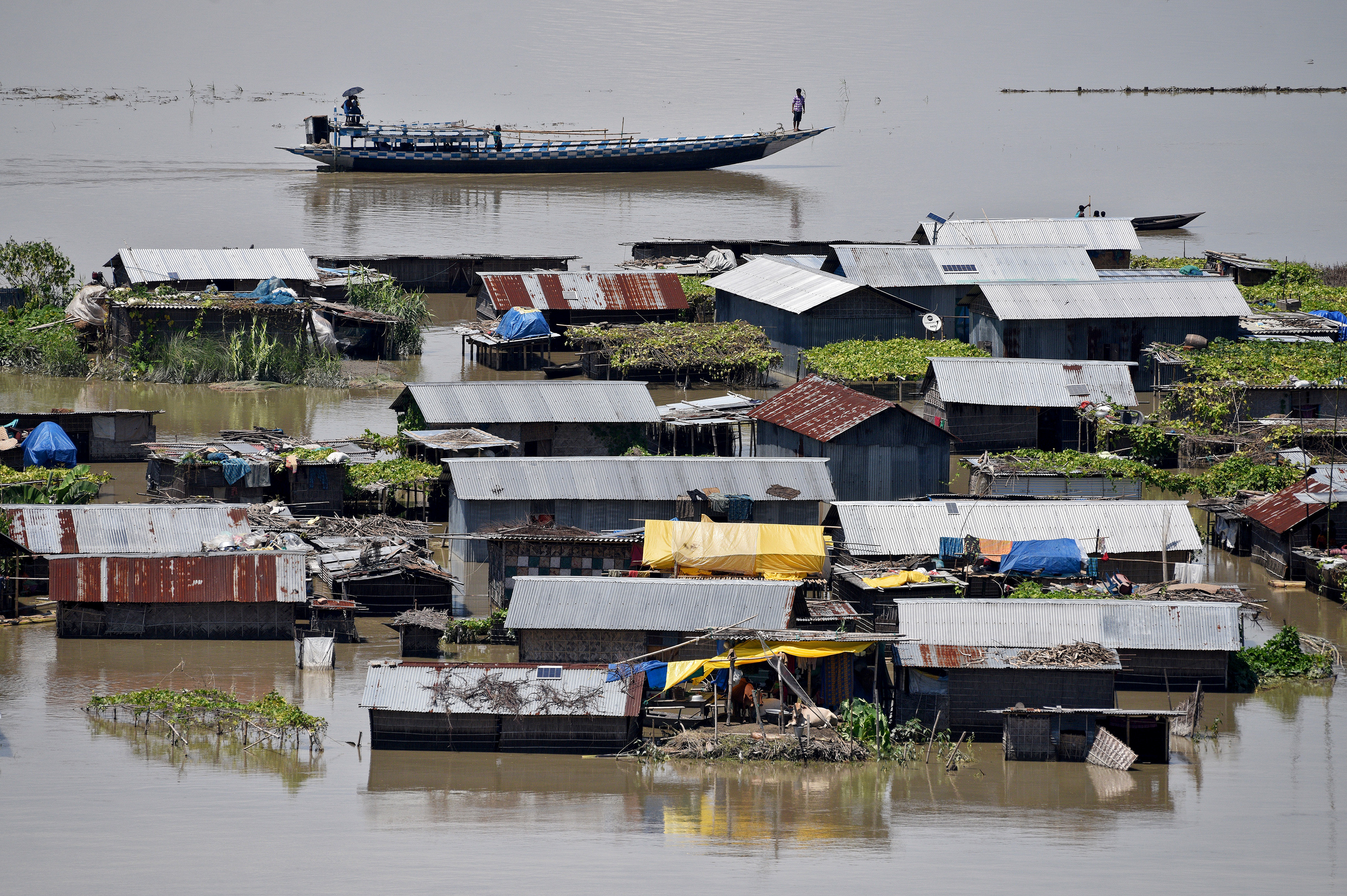
Villagers use a boat as they row past partially submerged houses at a flood-affected village in Morigaon district in Assam,

Villagers use a boat as they row past partially submerged houses at a flood-affected village in Morigaon district in Assam, July 14, 2017. REUTERS/Anuwar Hazarika

Torrential rains have also hit the northeastern states of Arunachal Pradesh, Nagaland and Manipur, killing at least 30 people.

Flood waters of the Brahmaputra river had earlier in July submerged the Kaziranga wildlife sanctuary in Assam. The floods have since killed more than 350 animals, including 24 endangered one-horned rhinoceros, five elephants and a tiger.

“We are facing a wildlife disaster,” Assam Forest Minister Pramila Rani Brahma told Reuters.

Meanwhile, in the eastern state of Bihar, at least 253 people lost their lives where incessant rains washed away crops, destroyed roads and disrupted power supplies.

A senior official in Bihar’s disaster management department, Anirudh Kumar, said nearly half a million people have been provided with shelter.

In Nepal, 141 people were confirmed dead, while thousands of survivors returned to their semi-destroyed homes.

“Their homes are in a state of total destruction,” said Francis Markus from International Federation of Red Cross and Red Crescent Societies.


(Reporting by Gopal Sharma in Kathmandu, Zarir Husain in Assam, Jatindra Das in Bhubaneswar, Ruma Paul in Dhaka; Writing by Rupam Jain in New Delhi,; Editing by Tommy Wilkes and Sherry Jacob-Phillips)


Hopes fade for over 130 feared buried in Sri Lanka landslides

A trishaw is seen stuck in the mud at Elangipitiya village in Aranayaka, Sri Lanka May 19, 2016.

By Ranga Sirilal

ARANAYAKA, Sri Lanka (Reuters) – Hopes faded on Thursday for the survival of about 130 people trapped under the mud and rubble of two landslides in Sri Lanka, as heavy rain hampered rescue operations and the death toll from the disaster rose to 58.

Days of torrential rains have forced around 300,000 people from their homes across the island nation, official data showed. Thirty bodies have been retrieved at the landslide sites.

That figure is likely to rise sharply as authorities battling muddy conditions begin to give up hope of reaching 132 people believed to be trapped beneath the landslides.

“I don’t think there will be any survivors,” Major General Sudantha Ranasinghe, the officer in charge of the rescue operation, told Reuters.

“There are places where the mud level is up to 30 feet. We will keep going until we can recover the maximum.”

Rescue efforts have focused on the town of Aranayaka, 100 km (60 miles) northeast of the capital, Colombo, where three villages with at least 66 houses were buried late on Tuesday in the central district of Kegalle.

Military officials used hoes and shovels to shift mud as they scrambled to find survivors amid heavy rain that made walking in the hilly terrain difficult.

Material from destroyed homes littered the area, including mud-swathed dog cages and water tanks, while a three-wheeler was seen partially buried.

The military pulled three bodies and parts of another two from rubble at the site of the second landslide that buried 16 people, Ranasinghe said.

H.P. Kamalawathi, 41, said she is still looking for her mother and two elder sisters, who were buried on Tuesday.

“We may get only the dead bodies,” the mother of two said as tears rolled down her cheeks. She and her family had sought safety in a nearly Buddhist temple.

“We can’t take any chance. We will dig and see,” Disaster Management Minister Anura Priyadharshana Yapa told reporters in Colombo after briefing diplomats and international bodies. Sri Lanka is seeking assistance to deal with the worst landslides in its history.

Health officials said they are monitoring for water-borne disease outbreaks while Yapa said the government has sought foreign aid in the form of motors, boats and purifying tablets.

Aid agencies in Colombo canvassed for boats to rescue hundreds of people trapped by rising river waters. Disaster management authorities said around 300,000 people displaced across the country by the disaster had been sent to 610 safe locations.

Troops also used boats and helicopters in rescue operations. The torrential rains since Sunday have caused floods and landslides in nineteen of the country’s 25 districts.

Flooding and drought are cyclical in Sri Lanka, which is battered by a southern monsoon between May and September, while a northeastern monsoon runs from December to February.

(Additional reporting and writing by Shihar Aneez; Editing by Catherine Evans)