Oregon wildfire displaces 2,000 residents as blazes flare across U.S. West

By Deborah Bloom

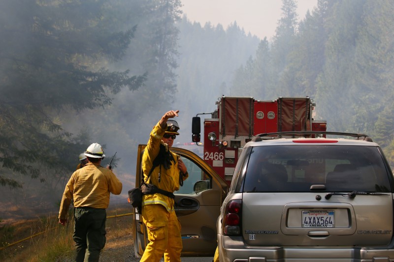
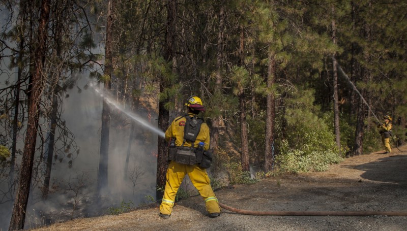
KLAMATH FALLS, Oregon (Reuters) -Hand crews backed by water-dropping helicopters struggled on Thursday to suppress a huge wildfire that displaced roughly 2,000 residents in southern Oregon, the largest among dozens of blazes raging across the drought-stricken western United States.

The Bootleg fire has charred more than 227,000 acres (91,860 hectares) of desiccated timber and brush in and around the Fremont-Winema National Forest since erupting on July 6 about 250 miles (400 km) south of Portland.

That total, exceeding the land mass of New York City, was 12,000 acres higher than Wednesday’s tally. Strike teams have carved containment lines around 7% of the fire’s perimeter, up from 5% a day earlier, but Incident Commander Joe Hessel said the blaze would continue to expand.

“The extremely dry vegetation and weather are not in our favor,” Hessel said on Twitter.

More than 1,700 firefighters and a dozen helicopters were assigned to the blaze, with demand for personnel and equipment across the Pacific Northwest beginning to strain available resources, said Jim Gersbach, a spokesman for the Oregon Department of Forestry.

“It’s uncommon for us to reach this level of demand on firefighting resources this early” in the season, he said.

Firefighter Garrett Souza, 42, a resident of the nearby town of Chiloquin, said Wednesday he and his team spent 39 hours straight on the “initial attack” of the fire last week.

“It’s the cumulative fatigue that really, I think, wears a person out over time,” he told Reuters, as he took a break from hacking at hotspots in the burn area.

No serious injuries have been linked to the Bootleg fire, officials said, but it has destroyed at least 21 homes and 54 other structures, and forced an estimated 2,000 people from several hundred dwellings placed under evacuation. Nearly 2,000 homes were threatened.

LARGEST OF MANY WILDFIRES

The Bootleg ranks as the largest by far of 70 major active wildfires listed on Thursday as having affected nearly 1 million acres in 11 states, the National Interagency Fire Center in Boise, Idaho, reported. It was also the sixth-largest on record in Oregon since 1900, according to state forestry figures.

Other states hard hit by the latest spate of wildfires include California, Idaho, Montana and Alaska.

As of Wednesday, the center in Boise put its “national wildland fire preparedness level” at 5, the highest of its five-tier scale, meaning most U.S. firefighting resources are currently deployed somewhere across the country.

The situation represents an unusually busy start to the annual fire season, coming amid extremely dry conditions and record-breaking heat that has baked much of the West in recent weeks.

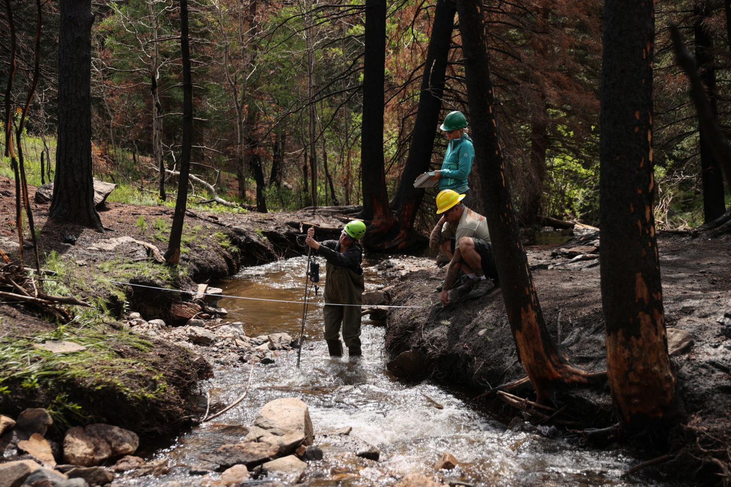
Scientists have said the growing frequency and intensity of wildfires are largely attributable to prolonged drought that is symptomatic of climate change.

One newly ignited blaze drawing attention on Thursday was the Dixie fire, which erupted on Wednesday in Butte County, California, near the mountain town of Paradise, still rebuilding from a 2018 firestorm that killed 85 people and destroyed nearly 19,000 structures in the state’s deadliest wildfire disaster.

The Dixie fire has charred about 2,250 acres (910 hectares) in its first 24 hours as some 500 personnel battled the blaze, which was spreading across a steep, rocky tree-filled terrain about 85 miles (140 km) north of Sacramento.

Erik Wegner of the U.S. Forest Service said dense stands of dead and dying trees created highly combustible conditions for the blaze. “It took off really fast,” he told Reuters.

Authorities have issued evacuation orders and warnings for several small communities in the area.

In Washington state, firefighters have contained about 20% of a lightning-caused fire near Nespelem, which has burned nearly 23,000 acres (9,270 hectares) northeast of Seattle since Monday, mostly on tribal lands of the Colville Reservation.

There were no injuries, but the blaze killed some livestock, destroyed three houses and forced evacuations of several others, officials said.

(Reporting by Deborah Bloom in Klamath Falls, Oregon; Additional reporting by David Ryder in Nespelem, Washington, and Mathieu Lewis Rolland in Butte County, California; Writing and additional reporting by Peter Szekely and Steve Gorman; Editing by David Gregorio, Daniel Wallis and Chris Reese)

Brutal heat wave persists in U.S. West as Oregon wildfire rages

(Reuters) – A punishing heat wave was again forecast to bring near-record temperatures to much of the U.S. West on Monday, as a wildfire in drought-stricken Oregon continued raging out of control.

The agency that manages California’s power grid, the California Independent System Operator, issued a “flex alert” urging residents to conserve power between 4 p.m. and 9 p.m. local time on Monday, after the Bootleg Fire in Oregon disrupted electric transmission lines.

The fire had burned through more than 153,000 acres (nearly 240 square miles) as of Monday morning, mostly in Oregon’s Fremont-Winema National Forest.

Hundreds of residents in the Klamath Falls area are under mandatory evacuation orders, and the Klamath County Sheriff’s Department has begun issuing citations and will consider the unusual step of making arrests if necessary people to enforce them, county officials said.

Other states have also confronted fires amid the heat. In California along the Nevada border, the Beckwourth Complex Fire had grown to around 89,600 acres (140 square miles) as of Monday morning, with approximately 23% containment, according to the state’s fire incident reporting system.

The National Weather Service predicted additional record highs on Monday in some areas, a day after Death Valley, California, hit a scorching 130 degrees Fahrenheit (54 Celsius), one of the highest temperatures ever recorded on Earth.

But forecasters said the intense heat had likely peaked across much of the region, ahead of more seasonable temperatures later this week.

(Reporting by Joseph Ax; Editing by Aurora Ellis)

U.S. West faces little-known effect of raging wildfires: contaminated water

By Donna Bryson

FORT COLLINS, Colo. (Reuters) – Early this spring, water bills arrived with notes urging Fort Collins Utilities customers to conserve. The Colorado customers may have thought the issue was persistent drought in the U.S. West.

But the problem was not the quantity of water available. It was the quality.

Utilities are increasingly paying attention to a little-known impact of large-scale fires: water contamination.

Huge forest fires last year denuded vast areas of Colorado’s mountains and left them covered in ash – ash that with sediment has since been washed by rains into the Cache la Poudre River. The river is one of two sources for household water in this college town of 165,000. With more and fiercer storms expected this year, officials worry about water quality worsening beyond what treatment systems can handle.

The problem could apply to watersheds across the U.S. West, which has faced ever-increasing extremes in heat, drought and wildfire amid climate change in recent years. The United States relies on water originating on forested land for about 80% of its freshwater supply, according to a government report.

“If a wildfire is not in my watershed, it will be in someone else’s watershed,” said Sean Chambers, director of water and sewer in the nearby northern Colorado town of Greeley.

So far, Chambers and other northern Colorado utilities managers have avoided clogged pipes simply by skipping the Cache la Poudre water and using other supplies. But they worry that’s not a long-term solution, and so they sent out those notes pleading with customers to voluntarily conserve: Water lawns sparingly. Don’t let the hose run on the sidewalk when washing your car.

THE COST OF WATER

Corporate headhunter Jim Croxton moved to Fort Collins so he could take in the mountain scenery while fishing.

“I really don’t care about how big the fish are,” Croxton said after buying a half dozen flies at a Fort Collins fishing and guide shop. “I just like to be out in” nature.

He had considered drought to be the West’s water concern. But the utility’s letter urging conservation struck a chord; he had read about polluting fires affecting recreational fishing, too.

“Water in the West is a central issue,” Croxton said.

Fort Collins water rates rose 2% from January. That works out to less than $1 per month for the typical home, and generates about $600,000 toward covering an estimated $45 million in potential fire-related measures, according to calculations prepared for Fort Collins City Council.

Those measures include laying mulch on burn scars to hold down soil, and funding further fire impact research. To make up the balance, officials in Fort Collins, Greeley and other communities are pooling resources and seeking state and federal help.

Katrina Jessoe is an economist at UC Davis who has advised utilities on seeking funding to decontaminate water supplies from pollutants such as fertilizers.

“You can’t get around the fact that the cost of water is getting higher,” which could be a concern for low- and middle-income earners, Jessoe said.

Water managers say they need also to explore new ways of raising funds and making capital improvements to deal with fire-related contamination, for example, removing tastes and odors left by algae fed by nutrients in the sediments washed into reservoirs. The tastes and odors don’t mean the water is unsafe, but customers don’t like it.

Water managers are “making decisions right now that will affect whether or not this is a livable place in 50 years, 100 years,” said John Matthews, who heads the Alliance for Global Water Adaptation, a nonprofit that advises on adapting water systems for climate change.

UNPRECEDENTED FIRES

The two fires that have marred the watersheds relied on by Fort Collins, Greeley, Thornton and other towns were notable not just for the devastation they caused, but for having burned at such high elevation.

“We really don’t understand these high-elevation fires very well, because they haven’t happened very often,” said Matt Ross, an ecosystem scientist at Colorado State University who is studying how last year’s fires are impacting algae blooms now.

The Cameron Peak Fire broke out in August and was the first in Colorado history to consume more than 200,000 acres, including swathes of the Arapahoe and Roosevelt national forests and Rocky Mountain National Park. The East Troublesome came close, burning 193,812 acres across the Continental Divide.

In both cases, flames tore through forests where rivers originate and where snowpack – that frozen reservoir – builds up over winter.

Given the large region burned, researchers need to understand how long it will take for vegetation to grow back, so it can keep sediment from washing into water sources, said biogeochemist Chuck Rhoades at the U.S. Forest Service.

“The implications are that people need to think a little bit more about how to manage and sustain reservoirs,” Rhoades said.

(Reporting by Donna Bryson; Editing by Katy Daigle and Lisa Shumaker)

Brutal heatwave to descend on U.S. West, prompting fire warnings

By Dan Whitcomb

LOS ANGELES (Reuters) – A heatwave already punishing parts of the U.S. Southwest on Monday was expected to move into California this week, prompting the forecasters to warn of health and fire dangers.

A high-pressure ridge that built over southwestern deserts over the past few days is responsible for the unusually blistering heat this early in the year, National Weather Service meteorologist Karleisa Rogacheski said.

“Today last day of seasonable weather in California,” Rogacheski said.

California saw balmy weather on Monday, with temperatures in the upper 80’s and low 90’s Fahrenheit (30-35°C), but forecasts called for warming on Tuesday, spiking into the triple digits by Thursday and lasting several days.

The weather service issued an excessive heat warning for parts of southwest Arizona, including Phoenix, on Monday, predicting “dangerously hot conditions” at least through Saturday.

“Very High Heat Risk. Increase in heat-related illnesses, including heat cramps, heat exhaustion, and heat stroke. Heat stroke can lead to death,” the NWS said in the advisory.

California’s dry winter left forests and brush parched, prompting worries that the heat wave could touch off wildfires.

Wildfires scorched more than 6,500 square miles (17,000 square km) of land in 2020, destroying hundreds of Californian homes during a particularly fierce fire season.

The baking weather could also strain California’s power grid as residents crank up air conditioning units across the state.

Experts say the heatwave forecast for this week, brought on by the early high pressure system, could not be blamed directly on climate change.

“It difficult to tie any one particular event to climate change,” said Eric Schoening, a meteorologist in the Salt Lake City office of the National Weather Service. “But studies show that as the climate changes and it gets warmer, we will see more of these anomalous events over time.”

(Reporting by Dan Whitcomb; Editing by Marguerita Choy)

Heat wave drives U.S. West power prices to highest since February freeze

(Reuters) – Extreme heat expected to blanket the U.S. West next week caused power prices for Monday to soar to their highest since the February freeze when natural gas pipelines and wind turbines froze in Texas leaving millions without power.

High temperatures will reach the low 90s F (about 34 C) in Los Angeles on Monday-Wednesday, which is about 20 degrees higher than the city’s normal high for this time of year, according to AccuWeather forecasts.

Last summer, a heat wave in August forced California utilities to impose rotating blackouts that left over 400,000 homes and businesses without power for up to 2-1/2 hours when energy supplies ran short.

The group responsible for North American electric reliability has already warned that California is the U.S. region most at risk of power shortages this summer because the state increasingly relies on intermittent energy sources like wind and solar, and as climate change causes more extreme heat events, drought and wildfires across the U.S. West.

Power traded on Friday for Monday delivery jumped to $151 per megawatt hour (MWh) at Palo Verde in Arizona and $95 in SP-15 in Southern California, their highest since the February freeze caused prices across the country to soar.

In addition to soaring power prices, gas for the rest of 2021 in California has traded at its highest in years on expectations an extreme drought in the U.S. West will cut hydropower supplies and force the state to rely more on gas-fired power plants this summer.

That would make it tough for California to reduce carbon dioxide emissions this year and shows how difficult it would be for the most-populous U.S. state to keep the lights on if it starts shutting gas-fired plants in the coming years as it moves toward getting all electricity from carbon-free sources by 2045.

(Reporting by Scott DiSavino; Editing by Steve Orlofsky)

Heavy snow in U.S. West and Midwest could disrupt post-Thanksgiving travel

(Reuters) – A major winter storm will lumber across the United States over the weekend, dumping snow as it moves east from the U.S. West and threatening to disrupt millions of people traveling home after celebrating the Thanksgiving holiday.

Over a foot of snow is forecast in mountainous parts of Colorado, Utah and Arizona on Friday before the storm system slips toward the upper Midwest, the National Weather Service said.

Freezing rain will likely turn to snowy blizzards in parts of Minnesota, Wisconsin and Michigan beginning on Friday night, with more than 18 inches of snowfall possible in some mountainous areas, the service said.

Some snow could appear in the Northeast by Sunday morning, the service said. New York City and other places further down the Atlantic Coast can expect a wintry mix of precipitation on Sunday.

More than 4 million Americans were expected to fly and another 49 million expected to drive at least 50 miles or more this week for Thanksgiving, according to the American Automobile Association.

Wintry weather disrupted travel this week ahead of Thursday’s Thanksgiving celebrations, with airports in Minneapolis and Chicago reporting hundreds of delayed or canceled flights.

(Reporting by Jonathan Allen in New York; Editing by Chizu Nomiyama)

Calmer winds bring hope in battle against deadly California blaze

Jul 30, 2018; Redding, CA, USA; Firefighters monitor fire movement as it crosses Highway 299 just west of Buckhorn Summit near the Trinity County line. Firefighters made progress on the fire which is now at 20 percent containment. Kelly Jordan via USA TODAY NETWORK

By Bob Strong

REDDING, Calif. (Reuters) – Some 3,600 firefighters struggling against one of the most destructive wildfires in California’s history hoped calmer winds on Tuesday would allow them to make more progress in carving out buffers to contain the blaze.

Six people have been confirmed killed and seven others have been missing since last Thursday. More than 800 homes and 300 other buildings have been reduced to ash and 37,000 people forced to evacuate as the Carr fire consumed 104,000 acres (42,000 hectares) in and around the town of Redding.

Jul 30, 2018; Redding, CA, USA; Todd Abercrombie, of Cal Fire watches the fire behavior as firefighters monitor fire movement as it crosses Highway 299 just west of Buckhorn Summit near the Trinity County line. Firefighters made progress on the fire which is now at 20 percent containment. Kelly Jordan via USA TODAY NETWORK

Jul 30, 2018; Redding, CA, USA; Todd Abercrombie, of Cal Fire watches the fire behavior as firefighters monitor fire movement as it crosses Highway 299 just west of Buckhorn Summit near the Trinity County line. Firefighters made progress on the fire which is now at 20 percent containment. Kelly Jordan via USA TODAY NETWORK

The firefighters reported some progress on Monday, having carved buffer lines around 23 percent of the fire’s perimeter, up from just 5 percent during much of the past week, thanks to calmer winds expected to remain in the area for two days.

The blaze, so far the seventh most destructive in Californian history, roared without warning into Redding and adjacent communities last week after being whipped by gale-force winds into a firestorm that jumped the Sacramento River.

It is the biggest of 17 wildfires now raging across the state, fueled by drought-parched vegetation, triple-digit temperatures, and unpredictable winds.

Two firefighters and at least four civilians were killed, including two young children and their great-grandmother who perished while huddled under a wet blanket.

Whole neighborhoods, including the town of Keswick on the outskirts of Redding, were laid to waste as residents fled for their lives in a chaotic evacuation. On Monday authorities began allowing some to return home, though an estimated 37,000 people still remained under mandatory evacuation orders.

Jul 30, 2018; Redding, CA, USA; Firefighters monitor fire movement as it crosses Highway 299 just west of Buckhorn Summit near the Trinity County line. Firefighters made progress on the fire which is now at 20 percent containment. Kelly Jordan via USA TODAY NETWORK

Jul 30, 2018; Redding, CA, USA; Firefighters monitor fire movement as it crosses Highway 299 just west of Buckhorn Summit near the Trinity County line. Firefighters made progress on the fire which is now at 20 percent containment. Kelly Jordan via USA TODAY NETWORK

To the southwest, the River and Ranch wildfires, known as the 23,000-acre Mendocino Complex, has forced thousands to evacuate as it has threatened 10,000 homes. About 2,000 firefighters are battling the blazes about 150 miles (240 km)north of San Francisco, where it has destroyed seven homes since it began on Friday, fire officials said.

Collectively, wildfires that have burned mostly in the U.S. West have scorched 4.6 million acres so far this year, 24 percent more than the average of burned landscape tallied for the same period over the past decade, according to federal data.

Authorities in California have reported levels of fire intensity and unpredictability they have seldom seen before. Statewide, wildfires have charred nearly 410,000 acres since January, the highest year-to-date total for the end of July in a decade, according to CalFire.


(Additional reporting by Brendan O’Brien; Editing by Richard Balmforth)

Prime wildfire weather is sweeping across western U.S.

The Sierra Hotshots, from the Sierra National Forest, are responding on the front lines of the Ferguson Fire in Yosemite in this US Forest Service photo from California, U.S. released on social media on July 22, 2018. Courtesy USDA/US Forest Service, Sierrra Hotshots/Handout via REUTERS

(Reuters) – Brutally hot temperatures, fierce winds and arid conditions will sweep across the U.S. West on Wednesday, and the weather may contribute to an already deadly wildfire season.

Temperatures above 100 degrees Fahrenheit (37 C), winds gusting up to 50 miles (80 km) per hour and humidity levels in the teens are in the forecast for many parts of Oregon, California, Arizona and Nevada on Wednesday and into Thursday, the National Weather Service said in a series of advisories.

The service warned that the weather could lead to more of the fires in the region, which have killed nine firefighters and destroyed more than 2,500 homes.

One of the largest, the Ferguson Fire, forced the Yosemite Valley and other parts of Yosemite National Park to close on Wednesday as smoke filled the air in the popular tourist destination.

The Ferguson Fire, which has been burning since July 13 and has claimed the life of one firefighter, had charred about 37,795 acres (15,295 hectares) to the south and west of the park. It was 26 percent contained as of Tuesday night, according to the California Department of Forestry and Fire Protection.

The park’s Yosemite Valley, Wawona and Mariposa Grove are to be closed at least through Sunday by the fire operations, the National Park Service said.

More than 3,400 personnel using 16 helicopters and 59 bulldozers have been battling the blaze, which has caused six injuries and led to evacuations in parts of the region.

In all, 73 major wildfires are burning in the United States in an area of about 700,000 acres. Most are in western states, with blazes also in central Texas and Wisconsin, according to the National Interagency Coordination Center.

As of July 24, wildfires had burned through 3.94 million acres this year, above the 10-year average for the same calendar period of 3.54 million acres, it said.

(Reporting by Brendan O’Brien in Milwaukee, editing by Larry King)