Tropical storm brewing off U.S. Gulf Coast, likely to hit Louisiana as hurricane

A flooded area is seen in New Orleans, Louisiana, U.S., July 10, 2019 in this image obtained from social media. David Mora via REUTERS

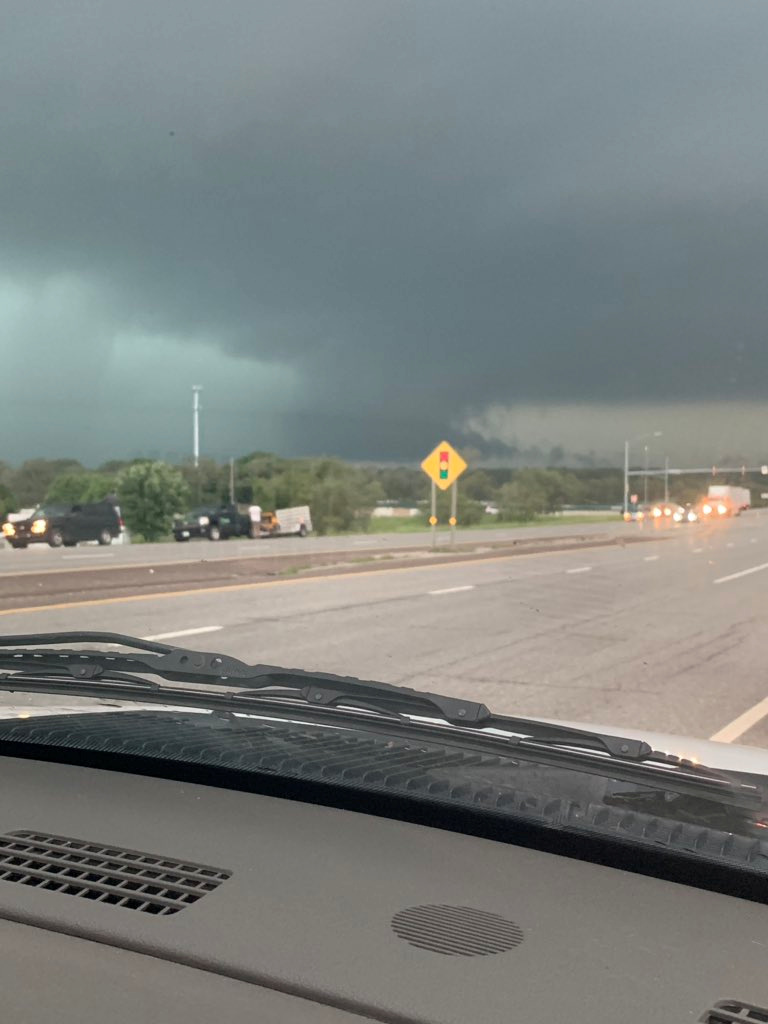
(Reuters) – A storm churning in the Gulf of Mexico and aimed at water-logged New Orleans was expected to make landfall as the first Atlantic hurricane of the 2019 season by late Friday or early Saturday, forecasters said.

A waterspout is seen on Lake Pontchartrain off New Orleans, Louisiana, U.S. July 10, 2019 in this image obtained from social media. Bryon Callahan via REUTERS

A waterspout is seen on Lake Pontchartrain off New Orleans, Louisiana, U.S. July 10, 2019 in this image obtained from social media. Bryon Callahan via REUTERS

The storm, which forecasters said might escalate to a tropical storm by late Thursday, had maximum sustained winds of 35 miles per hour (55 kph) as of Thursday morning, the National Weather Service said.

Meteorologists predicted between 10 and 20 inches (25 and 50 cm) of rain would fall on the Gulf Coast on Friday and Saturday from West Texas through New Orleans and the Louisiana coast.

“The whole area is in for a soaking, the worst of it on Saturday,” said David Roth, a meteorologist from the National Weather Service’s Weather Prediction Center.

The storm remained a tropical disturbance early on Thursday about 115 miles (185 km) south-southeast of the mouth of the Mississippi River, the National Hurricane Center said.

The storm will be named Barry if it strengthens into a tropical storm with winds of 39 mph or more on the Saffir Simpson hurricane scale. It will become Hurricane Barry if it reaches wind speeds of 74 mph (119 km) as expected when it makes landfall near the mouth of the Mississippi River and just west of New Orleans.

Louisiana Governor John Bel Edwards declared a state of emergency on Wednesday.

“The storm system will likely produce storm surge, hurricane-force winds,” he said at a news conference. “No one should take this storm lightly.”


A flooded area is seen in New Orleans, Louisiana, U.S., July 10, 2019 in this image obtained from social media. David Mora via REUTERS

A flooded area is seen in New Orleans, Louisiana, U.S., July 10, 2019 in this image obtained from social media. David Mora via REUTERSNational Guard troops were in place across the state, the governor said.

U.S. oil producers on Wednesday cut nearly a third of Gulf of Mexico crude output ahead of the storm.

Fifteen production platforms and four rigs were evacuated in the north-central Gulf of Mexico, according to a U.S. regulator as oil firms moved workers to safety.

New Orleans was already hit with widespread flooding on Wednesday from a weather system that might inundate the low-lying U.S. city.

The National Weather Service said the city had received 6 to 9 inches (15 to 23 cm) of rain by Thursday morning, causing dramatic flooding in the area, including on Bourbon Street in the city’s historic French Quarter.

Officials advised residents on Wednesday to stock up on emergency supplies and ordered evacuations in some vulnerable residential areas.

(Reporting by Rich McKay in Atlanta; Additional reporting by Alex Dobuzinskis in Los Angeles, Peter Sezekely and Gabriella Borter in New York; Editing by Toby Chopra and Bill Trott)

Life-threatening rains pound U.S. capital; White House basement offices leak

Flood waters are pictured in North Arlington, Virginia, U.S., July 8, 2019 in this picture grab obtained from social media video. Twitter/Hope Hodge Seck/@hopeseck/via REUTERS

WASHINGTON (Reuters) – Driving rains flooded parts of Washington, D.C., on Monday, shattering a daily record in just an hour, forcing 15 swift-water rescues from stranded cars and causing an undeniable leak in the White House.

“This is a life-threatening situation. Seek higher ground now!” the National Weather Service warned amid torrential rains that dropped 3.3 inches (8.4 cm) at Reagan National Airport from 9 a.m. through 10 a.m. ET (1200-1300 GMT), shattering in one hour the previous record of 2.2 inches (5.6 cm) set in 1958.

It was the seventh-wettest July day since record-keeping began in 1871, said NWS meteorologist Marc Chenard.

“They broke their daily record in an hour,” he said.

Even more rainfall was recorded further northwest, in Arlington, Virginia, where about 5 inches (12.7 cm) fell from 9 to 10 a.m., Chenard said.

The rains eased by late morning and were expected to end by midday, Chenard said.

Torrents of water streamed through the ceiling of Metro stations, and major arteries serving Washington’s top museums and memorials shut down due to high water as local emergency personnel reported rescuing several people from cars. By midday, DC Fire and EMS said it had saved 15 drivers.

Firefighters used yellow rubber lifeboats to rescue those trapped by the flood waters.

Twitter images showed a photograph of a very wet floor beneath office chairs and desks on the basement level of 1600 Pennsylvania Avenue.

“White House is leaking,” CNN journalist Betsy Klein tweeted with the picture.

(Reporting by Susan Heavey in Washington, additional reporting by Barbara Goldberg; Editing by Scott Malone and Dan Grebler)

Rains ease, Oklahoma, Arkansas and Louisiana still face flood of ‘historic magnitude’

A mattress and dresser drawer are among the debris scattered on a lawn near a damaged house after several tornadoes reportedly touched down, in Linwood, Kansas, U.S., May 29, 2019. REUTERS/Nate Chute

By Alex Dobuzinskis and Rich McKay

(Reuters) – Thousands of Arkansas, Oklahoma and Louisiana residents braced for more flooding on Thursday as swollen rivers continued to rise, although the threat of rain was expected to ease by the afternoon, officials said.

Many in the U.S. Southern states have already evacuated homes, as of further flooding drove fears that decades-old levees girding the Arkansas River may not hold.

There were no reports of major levee breaks early on Thursday, said Dylan Cooper, a meteorologist with the National Weather Service’s office in Little Rock, Arkansas.

“The rivers and tributaries are still rising from all that water flowing downstream from up north,” said Cooper.

“We call it the bathtub effect. There’s only so much water that the levees and reservoirs can hold before that water just spills over,” he said.

The only good news is that it looks like the area is going to have a dry few days into the weekend, said Bob Oravec, a meteorologist with the NWS Weather Prediction Center in College Park, Maryland.

“They can use any dry weather they can get,” said Oravec.

More than a week of violent weather, including downpours and deadly tornadoes, has lashed the central United States, bringing record-breaking floods in parts of the states, turning highways into lakes and submerging all but the roofs of some homes.

Arkansas Governor Asa Hutchinson told a news conference on Wednesday, that the state is experiencing a “flood of historic magnitude.”

Flooding has already closed 12 state highways, he said, and 400 households have agreed to voluntary evacuations.

Hutchinson sent a letter to U.S. President Donald Trump on Wednesday asking for a federal emergency declaration for Arkansas.

The levee system along the Arkansas River “has not seen this type of record flooding” before, Hutchinson said in his six-page letter.

Hutchinson said Trump had promised assistance in an earlier conversation, several media outlets reported.

Rivers were expected to crest by early June to the highest levels on record all the way down to Little Rock, Arkansas, forecasters said.

“We’ve had river highs of 44.9 feet in places,” said Cooper of the Arkansas River. “We’re blowing through records.”

In Tulsa, Oklahoma’s second largest city, Mayor G.T. Bynum warned that the city’s levees were being tested “in a way that they have never been before.”

He said the 20-mile (32 km) levee system, which protects some 10,000 people, was working as designed so far and being patrolled around the clock by the Oklahoma National Guard.

At least six people have died in the latest round of flooding and storms in Oklahoma, according to the state’s Department of Health.

More than 300 tornadoes have touched down in the Midwest in the past two weeks. Tornadoes pulverized buildings in western Ohio on Monday, killing one person and injuring scores.

In Louisiana, the Mississippi River was also at record flood levels due to record-breaking rainfalls this spring, forecasters said.

Trump authorized emergency aid from the Federal Emergency Management Agency for the state late on Wednesday.

In Baton Rouge, Louisiana, the Mississippi rose above flood stage in early January and has remained there since, forecasters said.

(Reporting by Alex Dobuzinskis in Los Angeles, Rich McKay in Atlanta, and Jonathan Allen in New York; Editing by Raissa Kasolowsky)

Arkansas, Oklahoma brace for historic flooding in storm-hit U.S. Midwest

A storm cloud is seen in Shawnee, Kansas, U.S. in this still image taken from a May 28, 2019 video obtained from social media. Daniel Hogue/via REUTERS

(Reuters) – Communities along the swollen Arkansas River in Oklahoma and Arkansas prepared on Wednesday for further flooding, with the mayor of Tulsa urging thousands of residents behind the city’s aging levees to be ready to evacuate in the event of a “worst-case scenario.”

More than a week of stormy weather, including violent downpours and deadly tornadoes, has devastated the central United States, bringing record-breaking floods in parts of the two states, turning highways into lakes and submerging all but the roofs of some homes.

More rain is forecast, and the floods are expected to spread, according to the National Weather Service (NWS) and local officials.

A tornado and storm cloud is seen in Eudora, Kansas, U.S. in this still from a video taken May 28, 2019 obtained from social media. AJ SCOTT /via REUTERS

A tornado and storm cloud is seen in Eudora, Kansas, U.S. in this still from a video taken May 28, 2019 obtained from social media. AJ SCOTT /via REUTERS

“The rain has been coming fast and furiously and it all has to drain through the rivers,” Patrick Burke, a meteorologist at the NWS Weather Prediction Center, said in an interview on Wednesday. More heavy downpours were forecast through Wednesday night over much of the two states, with between 1 and 3 inches (2.5 to 7.6 cm) expected, he said.

By early June, rivers are expected to crest to the highest levels on record all the way down to Little Rock, Arkansas, Burke said.

In Tulsa, Oklahoma’s second largest city, Mayor G.T. Bynum warned that the city’s 70-year-old levees were being tested “in a way that they have never been before.”

“Please prepare for the worst-case scenario that we’ve had in the history of the city,” he said on Tuesday. So far, he added, the 20-mile (32 km) levee system, which protects some 10,000 people, was working as designed.

At least six people have died as a result of the latest round of flooding and storms in Oklahoma, according to the state’s Department of Health.

The U.S. Army Corps of Engineers has raised the release of water from the Keystone Dam, in northeastern Oklahoma on the Arkansas and Cimarron rivers about 23 miles from Tulsa, into the river system to 275,000 cubic feet per second to stop the dam from overflowing.

A plague of extreme weather has upended life in the region, with more than 300 tornadoes touching down in the Midwest in the last two weeks.

Several tornadoes touched down on Tuesday evening in Kansas, damaging homes, uprooting trees and ripping down power lines, according to the NWS. Tornadoes also pulverized buildings in western Ohio, killing one person, and injuring scores of others.

(Reporting by Rich McKay in Atlanta and Jonathan Allen in New York; Editing by Scott Malone and Jeffrey Benkoe)

Tornadoes rip through Kansas after one killed, scores hurt by Ohio twisters

A man named Luther cleans up his driveway of debris after a tornado touched down overnight in city of Trotwood near Dayton, Ohio, U.S. May 28, 2019. REUTERS/Aaron Josefczyk

BROOKVILLE, Ohio (Reuters) – Several tornadoes reportedly touched down on Tuesday evening in Kansas to damage homes, uproot trees and rip down power lines, the National Weather Service (NWS) said.

About 20 tornadoes, including a large rain-wrapped twister near Kansas City, were reported to the NWS by storm chasers and spotters as news broadcast images of roofs torn off homes and roads scattered with debris and tree limbs.

“The house took a pretty good beating … but the main thing is that we are all safe,” homeowner Brian Perry told 41 Action News in Kansas City. “It was pretty wild, never been through anything like it in my life.”

The extent of the damage was unclear and there were no reports of fatalities or injuries.

The Kansas City International Airport said on Twitter that travelers found shelter in parking garage tunnels as the storms passed by the airfield. The airport later said it was closed as crews cleared debris.

The latest wave of tornadoes came a day after a spate of twisters pulverized buildings in western Ohio, killing one person, injuring scores and triggering a recovery effort in neighborhoods strewn with wreckage.

An 81-year-old man was killed in Celina, a small city 65 miles (105 km) north of Dayton, after a tornado sent a vehicle crashing into his home, Mayor Jeffrey Hazel told a news conference.

More than 300 tornadoes have ravaged the U.S. Midwest in the last two weeks, during an unusual onslaught of extreme weather.

The tornado in Celina, which touched down late on Monday, was at least an EF3 on the Enhanced Fujita Scale, packing wind speeds of 136 mph to 165 mph (219 kph to 266 kph), said Patrick Marsh, a meteorologist at the federal Storm Prediction Center.

The storm injured seven people in Celina, three of them seriously, Hazel said, and about 40 homes there were seriously damaged or destroyed.

Two tornadoes categorized as EF3 or stronger also struck late on Monday near Dayton, including one just south of Wright-Patterson Air Force Base, Marsh said. An EF3 is just two scales lower than the most intense tornado possible, an EF5.

Damaged property is seen after a tornado in Lawrence, Kansas, U.S. in this still from a video taken May 28, 2019 obtained from social media. LOUIS CORTEZ /via REUTERS

Damaged property is seen after a tornado in Lawrence, Kansas, U.S. in this still from a video taken May 28, 2019 obtained from social media. LOUIS CORTEZ /via REUTERS

‘LIKE A FREIGHT TRAIN’

Sue Taulbee, 71, was watching television in her bed in the Dayton suburb of Brookville when she heard an approaching twister.

“They say it’s like a freight train: That’s what I heard,” she recalled on Tuesday afternoon. She hid at the foot of the bed. Flying debris smashed her window and she was soon trapped as her home collapsed around her.

“It was only a couple of minutes, but it seemed like an hour,” she said as she sat in her yard, surrounded by her scattered possessions.

“I just started screaming and my neighbors heard me and said, ‘Sue! Sue! I hear you! We’re coming! We’re coming!'”

They pulled her out through a hole and brought her to a hospital to treat a cut on her head, she said.

After the twisters, Ohio Department of Transportation crews used snow plows to clear highways of debris.

The risk of more tornadoes continued into the night on Tuesday in some Midwest states and the mid-Atlantic states of Pennsylvania, New Jersey and southern New York, Marsh said.

‘THROWN AROUND’

Nearly 80 people in and around Dayton went to hospitals with injuries, said Elizabeth Long, a spokeswoman for the Kettering Health Network.

“We’ve had injuries ranging from lacerations to bumps and bruises from folks being thrown around in their houses due to the storms,” Long said.

The flurry of hundreds of tornadoes that has recently struck the Midwest was caused by the interaction of moisture from the Gulf of Mexico, a strong jet stream and a weather front that has been locked in place, said Alex Lamers, a meteorologist with the federal Weather Prediction Center.

Joseph Taulbee, 21, Allyson Smith, 25, and Danielle,Taulbee, 24, work to collect memorabilia from their grandmother’s damaged house after a tornado touched down overnight in Brookville, near Dayton, Ohio, U.S. May 28, 2019. REUTERS/Kyle Grillot

Nearly 55,000 homes and businesses in Ohio were without power on Tuesday, according to the PowerOutage.US tracking service, and officials advised people to boil water after water plants and pumps halted.

The latest storm follows tornadoes and floods that killed at least three people in Missouri and six people in Oklahoma during the previous week, including two in El Reno on Saturday.

Unexpected pipeline outages and refinery shutdowns over the past week – in part caused by bad weather in the U.S. Midwest – have roiled cash markets for both crude oil and refined products, traders said.

Rainfall could trigger flash flooding on Tuesday evening in parts of Nebraska, Kansas, Missouri and Iowa, said Brian Hurley, a senior meteorologist at the federal Weather Prediction Center.

(This story corrects dateline and name of Dayton suburb in paragraph 12 to Brookville, not Brookline)

(Reporting by Kyle Grillot in Brookville, Ohio; Additional reporting by Rich McKay in Atlanta, Jonathan Allen and Peter Szekely in New York, Alex Dobuzinskis in Los Angeles and Brendan O’Brien in Milwaukee; Editing by Grant McCool and Clarence Fernandez)

Death toll from storms lashing central U.S. rises to seven

A member of the Jefferson City Fire Department checks houses for people on Woodland Avenue following a tornado touchdown overnight in Jefferson City, Missouri, U.S. May 23, 2019. REUTERS/Antranik Tavitian

By Antranik Tavitian

JEFFERSON CITY, Mo. (Reuters) – The latest in a line of destructive storms pounding the central United States killed at least three people as tornadoes raked across Missouri while heavy rain flooded rivers in Oklahoma, authorities said on Thursday.

The three deaths and several injuries were recorded in and around Golden City, Missouri, some 30 miles (48 km) northeast of Joplin where a tornado touched down on Wednesday evening, the Missouri Department of Public Safety said on Twitter.

A damaged car is parked on Woodlawn Avenue following a tornado touchdown overnight in Jefferson City, Missouri, U.S. May 23, 2019. REUTERS/Antranik Tavitian

A damaged car is parked on Woodlawn Avenue following a tornado touchdown overnight in Jefferson City, Missouri, U.S. May 23, 2019. REUTERS/Antranik Tavitian

The casualties brought the week’s weather-related death toll to at least seven, as forecasters said the rain and threat of damaging winds were not expected to let up.

“It looks to stay quite wet over the next week across the central portion of the country,” said meteorologist Mark Chenard of the National Weather Service (NWS) Weather Prediction Center in College Park, Maryland.

A system of showers stretched from the Texas Panhandle and western Oklahoma north to Nebraska on Thursday, threatening to bring more flooding, Chenard said. A diminished threat of tornadoes will persist from the Texas Panhandle through Kansas, he said.

In Jefferson City, the state capital of Missouri, officials said a “massive” twister caused widespread damage but no fatalities.

“Many, many buildings have significant damage, and there’s a lot of them that just have small damage as well, so it’s just very widespread,” Jefferson City Mayor Carrie Tergin told CNN.

Missouri Governor Mike Parson said at least 20 people were treated at hospitals but that most had been released.

A firefighter and FEMA employee survey damage on Woodlawn Avenue following a tornado touchdown overnight in Jefferson City, Missouri, U.S. May 23, 2019. REUTERS/Antranik Tavitian

A firefighter and FEMA employee survey damage on Woodlawn Avenue following a tornado touchdown overnight in Jefferson City, Missouri, U.S. May 23, 2019. REUTERS/Antranik Tavitian

“The damage tornadoes & severe storms cause is devastating, but I am encouraged & inspired by storm survivors. In a time of tragedy, Missourians came together and cared for their neighbors, and our first responders acted with speed & skill to rescue survivors,” Parson wrote on Twitter.

U.S. President Donald Trump said on Twitter that his heart went out to the people of Missouri.

“You are strong and resilient, and we are here to assist,” he wrote.

Trump also urged Oklahomans to stay safe and listen to the warnings of local officials. “We are with you!” he tweeted.

Earlier this week, a tornado killed at least one person in Iowa, while two people in Oklahoma died in accidents on rain-slicked roads and a third in flooding.

The Arkansas River town of Webbers Falls was ordered evacuated on Thursday, while residents of several other communities were advised to leave, Oklahoma Department of Emergency Management spokeswoman Keli Caine said by phone.

(Reporting by Peter Szekely in New York, Rich McKay in Atlanta and Dan Whitcomb in Los Angeles; Editing by Daniel Wallis and Tom Brown)

Tornadoes kill three, hit U.S. Plains state capital

Damage is seen on a street after a tornado in Jefferson City, Missouri, U.S. May 23, 2019, in this image taken from social media. Tyler Thompson/via REUTERS T

By Rich McKay

(Reuters) – Tornadoes killed at least three people in southwest Missouri and slammed into the state capital just before midnight on Wednesday, with rescue workers in Jefferson City searching into the morning for the injured, officials said.

The St. Louis office of the National Weather Service confirmed that reported twisters hit near Joplin, Mo., late Wednesday, and local media including the Joplin Globe reported at least three dead.

No other information about the deaths was immediately available from officials early Thursday.

The NWS reported that a “massive” twister also hit the southeastern part of Jefferson City, damaging buildings, toppling trees and power lines and tossing around parked cars.

There were no immediate reports of fatalities in the city as of early Thursday, said Jared Maples, a meteorologist with the NWS St. Louis office.

A damaged sign is seen after a tornado in Jefferson City, Missouri, U.S. May 23, 2019, in this still image taken from video obtained from social media. Jared Sheneman/via REUTERS

A damaged sign is seen after a tornado in Jefferson City, Missouri, U.S. May 23, 2019, in this still image taken from video obtained from social media. Jared Sheneman/via REUTERS

The Jefferson City Fire Department was sending rescuers house-to-house searching for people in need, officials posted on social media, with reports of people trapped in debris.

“We’re doing okay but praying for those that were caught in damage, some still trapped,” Missouri Gov. Mike Parson said on Twitter early Thursday.

Maples said, “As of this morning, the main parts of the storms have pushed eastward, thank goodness,” leaving the region to deal with just another expected two inches of rain through Friday.

At least three other people have been killed since Monday in Oklahoma and Iowa in a string of at least 30 tornadoes, heavy rains and floods that hit a swath from Texas to Illinois since Monday.

Residents in sections of Jefferson were under orders to evacuate Thursday ahead of the expected crest of the Missouri River at least 2 feet above the 30-foot high levees.

Rainfall is predicted to be about 2 inches (5 cm) across eastern Kansas, Oklahoma, and into western Missouri, with localized spots getting up to 5 inches (13 cm), forecasters said.

(Reporting by Rich McKay in Atlanta, Editing by William Maclean)

U.S. south ‘still under the gun’ after deadly storms

A storm cloud formation is seen in Collinsville, Oklahoma, U.S., May 20, 2019 in this picture obtained from social media on May 21, 2019. BRI'ANNE WALTON/via REUTERS

By Rich McKay

(Reuters) – A storm system that blasted the U.S. South was weakening on Tuesday but another was on its way after thunderstorms and tornadoes left a swath of destruction, killed at least two people and tore up a NASCAR grandstand.

More than 30 tornadoes struck on Monday and Tuesday from Texas, Oklahoma and across the southern plains into Missouri, said meteorologists with the National Weather Service.

While this weakening storm system is expected to roll into the Great Lakes region early Wednesday, another system is brewing Wednesday night into Thursday, said Brian Hurley, a forecaster with the NWS Weather Prediction Center.

“The Southern Plains can’t catch a break,” Hurley said. “More storms will develop overnight into Thursday morning.”

Rainfalls are predicted to be about 2 inches across eastern Kansas, Oklahoma, and into western Missouri, with localized spots getting up to 5 inches, he said.

“That whole area is still under the gun,” Hurley said.

In Wheatland, Missouri, at the Lucas Oil Speedway, a reported tornado injured 7 people, flipped over cars, toppled campers and damaged the grandstands, with local media images showing piles of twisted metal and upside down vehicles.

The Memorial Day weekend “Lucas Oil Show-Me 100” races at the speedway, about 120 miles southeast of Kansas City, were canceled indefinitely. A crowd topping 3,000 fans of the National Association for Stock Car Auto Racing (NASCAR) had been expected, track officials said on Tuesday.

Dozens of people were rescued from rising floodwaters and felled trees that smashed homes and blocked roadways in Oklahoma on Tuesday.

Crews using boats pulled at least 50 people from rising water as heavy downpours inundated roads and homes, Oklahoma Emergency Management Agency spokeswoman Keli Cain said.

Two deaths from a traffic accident on a rain-slicked Missouri highway were reported by police late Monday.

Missouri Gov. Mike Parson declared a state of emergency on Tuesday for the state, out of concern for floods from cresting rivers and streams, with forecasts of more rain on the way.

Forecasters said the Missouri River is expected to crest on Thursday at more than 32 feet at the state capital of Jefferson City. Local media including NBC News said that is two feet higher than the city’s levees.

(Reporting by Rich McKay in Atlanta; additional reporting by Brendan O’Brien in Milwaukee and Dan Whitcomb in Los Angeles; Editing by Peter Graff)

Second wave of twisters in U.S. South turns deadly as storm pushes east

4-19-2019 Twitter photograph of Macron, MS twitter - Bryce Jones

By Rich McKay

(Reuters) – A second wave of tornadoes and thunderstorms to hit the U.S. South and Midwest this week turned deadly on Thursday with three people reported killed, as the storms pushed eastward on Friday, officials and media accounts said.

One person was killed after a tree fell on his vehicle in Neshoba County, Mississippi, Thursday afternoon, the local paper, the Neshoba Democrat, reported.

A second death was reported in St. Clair County, Mississippi, after a tree fell on a home, late Thursday, according to AccuWeather.

A third death was reported late Thursday in the Wattsville community, north of Pell City, Alabama, the National Weather Service (NWS) reported, after a tree fell on a home.

The deaths come in the wake of at least five people, including three children, who were killed last weekend in a storm system that drove more than three dozen tornadoes across the U.S. South.

Communities in central Texas and western Louisiana, already hit by flash floods and twisters in the first round last weekend, were hit once more by high winds, twisters, egg-sized hail and intense rain Thursday and Friday, according to AccuWeather and the NWS.

In the latest storm system, multiple possible tornadoes hit southwest and central Mississippi Thursday night and early Friday, the NWS said, but the damage will have to be surveyed before confirmation of twisters.

“We’re still under some severe storm warnings, tornado watches and flood warnings into this morning and the afternoon across a broad swipe of the U.S.,” said NWS meteorologist Bob Oravec early Friday.

“The severe thunderstorms will impact the deep South and southeastern U.S., through Georgia and the Florida panhandle, before it heads up the Atlantic Coast,” he said.

Flash flooding could remain a threat in Maine, New Hampshire and Massachusetts on Saturday, the weather service said.

The storm system will lose much of its punch late in the weekend, but the East Coast should expect a soggy Easter, Oravec said.

Power outages were reported early Friday in Texas, Mississippi, Alabama and Tennessee, affecting a total of about 91,800 homes and businesses, according to the tracking site PowerOutage.Us.

(Reporting by Rich McKay; Editing by Mark Potter)

Deadly storms leave thousands without power in eastern U.S

A view of clouds, part of a weather system seen from near Franklin, Texas, U.S., in this still image from social media video dated April 13, 2019. TWITTER @DOC_SANGER/via REUTERS

(Reuters) – Tornadoes, wind gusts of up to 70 mph and pounding hail remained threats early on Monday from eastern New York and into New England, as the remnants of a deadly storm push out to sea, the National Weather Service said.

More than 79,000 homes and businesses were without power in Virginia, according to the tracking site PowerOutage.US, with 89,000 more outages reported across Pennsylvania, North Carolina, Michigan, Maryland and New York.

The affected areas will get heavy rains, winds with gusts of up to 70 mph (110 kph) and the possibility of hail, NWS Weather Prediction Center in Maryland said.

“This is an ongoing threat,” said Brian Hurley, from the center.

“There are short spin-ups, pockets of heavy rain and damaging winds that can still hit before this pushes off shore.”

The weekend’s storm brought tornadoes that killed at least five people, including three children, in the U.S. South, officials said.

The massive storm system sped from Texas eastward with dozens of twisters reported as touching down across the South from Texas through Georgia into Pennsylvania.

Nearly 2,300 U.S. flights were canceled by Sunday evening, more then 90 percent of them at airports in Chicago; Houston, Texas; Charlotte, North Carolina; Pittsburgh; Columbus, Ohio and a dozen major airports on the Eastern Seaboard, according to FlightAware.com.

But no major flight delays were reported on the east coast before 6 a.m. Monday.

The storm’s cold front brought snow to Chicago on Sunday, with 1 to 3 inches (2.5-7.6 cm) reported in central Illinois.

Two children, siblings aged three and eight, were killed on Saturday when a tree fell on the car in which they were sitting in Pollok, Texas, said a spokeswoman for the Angelina County Sheriff’s Department.

A third child, Sebastian Omar Martinez, 13, drowned late on Saturday when he fell into a drainage ditch filled with flash floodwaters near Monroe, Louisiana, said Deputy Glenn Springfield of the Ouachita Parish Sheriff’s Office.

In another storm death nearby, an unidentified victim’s body was trapped in a vehicle submerged in floodwaters in Calhoun, Louisiana, Springfield said.

In Mississippi, Governor Phil Bryant said one person was killed and 11 injured over the weekend as tornadoes ripped through 17 counties and left 26,000 homes and businesses without electricity.

In addition, three people were killed when a private jet crashed in Mississippi on Saturday, although Bryant said it was unclear whether it was caused by the weather.

Soaking rains could snarl the Monday morning commute on the East Coast before the storm moves off to sea.

“The biggest impact rush hour-wise probably will be Boston, around 7 to 8 o’clock in the morning, and around New York City around 5 or 6 o’clock, before sunrise,” NWS meteorologist Bob Oravec said.

(Reporting by Rich McKay in Atlanta, and Barbara Goldberg and Peter Szekely in New York; Editing by Hugh Lawson and Alison Williams)