California Earthquakes, many aftershocks jolt the San Fransisco area this week

The San Andreas Fault line. By Kate Barton, David Howell, and Joe Vigil -

By Kami Klein

A series of earthquakes have been hitting California in the last few days.

According to The Wall Street Journal, the quakes began Monday at 10:33 p.m., when a magnitude 4.5 temblor rattled out of the suburbs of Contra Costa County, in the East Bay about 20 miles northeast of San Francisco. The USGS reported at least 26 aftershocks following the tremor, Then, on Tuesday at 12:42 p.m., a magnitude 4.7 quake struck in the remote mountains of San Benito County. No major structural damage was reported.

On Tuesday evening another earthquake this one rated at 3.4 also struck the Pleasant Hill area. The quake was recorded at 7:11 p.m. pacific, Tuesday, Oct. 15 and was centered under Pleasant Hill at a depth of 9 miles, the USGS reported.

Monday’s quake was the latest reminder that seismic forces put the East Bay at high risk of a major earthquake, including from the dangerous Hayward Fault, which runs along heavily populated areas. The Los Angeles Times also reported that the earthquakes struck on an unusual section of San Andreas fault known for ‘creeping’, a series of smaller earthquakes that could lead to larger ones along the fault line.

“This is the 10th earthquake larger than magnitude 4 in the last 20 years in this area” within a radius of about six miles from Tuesday’s epicenter said Keith Knudsen, USGS geologist and deputy director of the agency’s Earthquake Science Center.

In 2008 the USGS created “The Great ShakeOut” scenario to warn communities to prepare the bay area for larger quakes. This scenario was based on a potential magnitude 7.8 earthquake on the southern San Andreas Fault— approximately 5,000 times larger than the magnitude 5.4 earthquake that shook southern California on July 29, 2008. It’s not a matter of if an earthquake of this size will happen—but when.

Dr. Lucy Jones of the U.S. Geological Survey led a group of over 300 scientists, engineers, and others to study the likely consequences of this potential earthquake in great detail. The result is the ShakeOut Earthquake Scenario, which was also the basis of a statewide emergency response exercise, Golden Guardian 2008.

In an earthquake of this size, the shaking will last for nearly two minutes. The strongest shaking will occur near the fault (in the projected earthquake, the Coachella Valley, Inland Empire and Antelope Valley). Pockets of strong shaking will form away from the fault where sediments trap the waves (in the projected earthquake, it would occur in the San Gabriel Valley and in East Los Angeles).
Such an earthquake will cause unprecedented damage to Southern California—greatly dwarfing the massive damage that occurred in Northridge’s 6.7-magnitude earthquake in 1994. In summary, the ShakeOut Scenario estimates this earthquake will cause over 1,800 deaths, 50,000 injuries, $200 billion in damage and other losses, and severe, long-lasting disruption.

UK faces food, fuel and drug shortages, says contested leaked document

FILE PHOTO: A line of trucks is seen during a trial between disused Manston Airport and the Port of Dover of how road will cope in case of a "no-deal" Brexit, Kent Britain January 7, 2019. REUTERS/Toby Melville/File Photo

By Kate Holton and William James

LONDON (Reuters) – Britain will face shortages of fuel, food and medicine if it leaves the European Union without a transition deal, according to leaked official documents reported by the Sunday Times whose interpretation was immediately contested by ministers.

Setting out a vision of jammed ports, public protests and widespread disruption, the paper said the forecasts compiled by the Cabinet Office set out the most likely aftershocks of a no-deal Brexit rather than the worst-case scenarios.

But Michael Gove, the minister in charge of coordinating “no-deal” preparations, challenged that interpretation, saying the documents did set out a worst-case scenario and that planning had been accelerated in the last three weeks.

The Times said up to 85% of lorries using the main Channel crossings may not be ready for French customs, meaning disruption at ports would potentially last up to three months before the flow of traffic improved.

The government also believes a hard border between the British province of Northern Ireland and the Republic of Ireland, an EU member, will be likely as plans to avoid widespread checks will prove unsustainable, the Times said.

“Compiled this month by the Cabinet Office under the codename Operation Yellowhammer, the dossier offers a rare glimpse into the covert planning being carried out by the government to avert a catastrophic collapse in the nation’s infrastructure,” the Times reported.

Prime Minister Boris Johnson’s office said it did not comment on leaked documents. But Gove said it was an old document that did not reflect current preparedness.

“It is the case, as everyone knows, that if we do have a no-deal exit there will inevitably be some disruption, some bumps in the road. That’s why we want a deal,” Gove told reporters.

“But it is also the case that the UK government is far more prepared now than it was in the past, and it’s also important for people to recognize that what’s being described in these documents… is emphatically a worst-case scenario,” Gove added.

A government source blamed the leak on an unnamed former minister who wanted to influence negotiations with the EU.

“This document is from when ministers were blocking what needed to be done to get ready to leave and the funds were not available,” said the source, who declined to be named. “It has been deliberately leaked by a former minister in an attempt to influence discussions with EU leaders.”

NO TURNING BACK

The United Kingdom is heading toward a constitutional crisis and a showdown with the EU as Johnson has repeatedly vowed to leave the bloc on Oct. 31 without a deal unless it agrees to renegotiate the Brexit divorce.

Yet after more than three years of Brexit dominating EU affairs, the bloc has repeatedly refused to reopen the Withdrawal Agreement.

Brexit minister Stephen Barclay said on Twitter he had signed a piece of legislation which set in stone the repeal of the 1972 European Communities act – the laws which made Britain a member of the organization now known as the EU.

Though his move was largely procedural, in line with previously approved laws, Barclay said in a statement: “This is a clear signal to the people of this country that there is no turning back (from Brexit).”

A group of more than 100 lawmakers wrote to Johnson calling for an emergency recall of parliament to discuss the situation.

“We face a national emergency, and parliament must now be recalled in August and sit permanently until October 31 so that the voices of the people can be heard, and that there can be proper scrutiny of your government,” the letter said.

Johnson will this week tell French President Emmanuel Macron and German Chancellor Angela Merkel that the Westminster parliament cannot stop Brexit and a new deal must be agreed if Britain is to avoid leaving the EU without one.

Merkel said during a panel discussion at the Chancellery: “We are prepared for any outcome, we can say that, even if we do not get an agreement. But at all events, I will make an effort to find solutions – up until the last day of negotiations.”

Johnson is coming under pressure from politicians across the political spectrum to prevent a disorderly departure, with opposition leader Jeremy Corbyn vowing to bring down Johnson’s government to delay Brexit.

It is, however, unclear if lawmakers have the unity or power to use the British parliament to prevent a no-deal departure, likely to be the UK’s most significant foreign policy move since World War Two.

(Editing by Gareth Jones and David Holmes)

Shaken communities take stock of damage after Southern California quakes

A house left destroyed by a powerful magnitude 7.1 earthquake, triggered by a 6.4 the previous day, is seen at night near the epicenter in Trona, California, U.S., July 6, 2019. REUTERS/David McNew

By Alan Devall

RIDGECREST, Calif. (Reuters) – High desert communities in Southern California on Saturday assessed damage and braced for potentially dangerous aftershocks from a major earthquake that shook buildings, ruptured gas lines and sparked fires near the remote epicenter of the second temblor in as many days.

A house is left destroyed by an earthquake, triggered by a previous day quake, near the epicenter in Trona, California, U.S., July 6, 2019. REUTERS/David McNew

A house is left destroyed by an earthquake, triggered by a previous day quake, near the epicenter in Trona, California, U.S., July 6, 2019. REUTERS/David McNew

The powerful magnitude 7.1 earthquake rocked the Mojave Desert town of Ridgecrest south of Death Valley National Park as darkness fell on Friday, jolting the area with eight times more force than a 6.4 quake that struck the same area 34 hours earlier.

California Governor Gavin Newsom placed the state Office of Emergency Services (OES) on its highest alert and requested federal assistance.

He told a news conference in Ridgecrest on Saturday that he had just got off a phone call with U.S. President Donald Trump, seeking a presidential emergency declaration.

“I have full confidence that the president will be forthcoming, in immediate terms, with the formal declaration,” Newsom said, flanked by first responders.

Cracks emerge on a road after an earthquake broke in Trona, California, U.S., in this photo from the USGS posted on July 6, 2019. USGS/Handout via REUTERS

Cracks emerge on a road after an earthquake broke in Trona, California, U.S., in this photo from the USGS posted on July 6, 2019. USGS/Handout via REUTERS

There were several minor to moderate injuries, OES Director Mark Ghilarducci told reporters.

“No reports of any fatalities, so I think we’re very lucky there,” he said.

There were reports of building fires, mostly as a result of gas leaks or gas-line breaks, Ghilarducci said.

State officials said all roads damaged by the quakes had been repaired and reopened.

Violent shaking also caused water-main breaks and knocked out power and communications to parts of Ridgecrest, home to about 27,000 people some 125 miles (200 km) northeast of Los Angeles.

Officials warned there was sure to be a significant number of aftershocks, including possible powerful ones, and advised residents to ensure they had necessary supplies.

“I’ve said this ad nauseam: be prepared for the worst,” said Newsom, who on Saturday met victims in the hospital and visited a hardware store where the earthquake hurled products from shelves and left ceiling tiles scattered across the aisles.

Standing outside her damaged home in Ridgecrest, life-long resident Sierra Wood said it was heartbreaking and scary.

“This is the first time I’ve ever seen anything like this,” she said. “I mean – they say that it’s happened and you’ve heard about it. But once you’re in it, it’s completely different, it’s terrifying. It’s terrifying.”

Her husband, Keith Wood, said the aftershocks were grueling.

“It’s like when, when do we get a break from it?” he said. “When is enough enough? Mother Nature has had her way. Give us a break now, OK?”

Evacuees leave a fire station with their belongings after an earthquake near Trona, California, U.S. July 6, 2019. REUTERS/Gene Blevins

Evacuees leave a fire station with their belongings after an earthquake near Trona, California, U.S. July 6, 2019. REUTERS/Gene Blevins

The sprawling U.S. Naval Air Weapons Station China Lake just northwest of Ridgecrest was evacuated of all non-essential personnel following the quake.

The facility, which at more than 1.1 million acres (445,000 hectares) is larger than the state of Rhode Island, reported no injuries. Authorities were assessing any damage to buildings or other infrastructure, according to a post on the base’s Facebook page.

MORE TO COME

Friday’s earthquake was widely felt across Southern California, including greater Los Angeles, where shaking in some areas lasted about 40 seconds. Low-level rumbling extended as far north as the San Francisco Bay area and beyond to Reno, Nevada, and as far east as Phoenix, Arizona.

Seismologists said the initial quake on Thursday, and scores of smaller ones that followed it, proved to be foreshocks to Friday’s larger temblor, which now ranks as Southern California’s most powerful since a 7.1 quake that struck near a U.S. Marine Corps base in the Mojave Desert in 1999.

The U.S. Geological Survey said Friday’s quake was immediately followed by at least 16 aftershocks of magnitude 4 or greater and warned of a 50 percent chance of another magnitude 6 quake in the coming days. Geologists put the chance of another magnitude 7 tremor at 10 percent over the next week.

There were hundreds of aftershocks of 2.5 magnitude or greater in the area surrounding the epicenter, according to USGS data.

Victor Abdullatif was helping clean up broken bottles and other debris inside his father’s liquor store, the Eastridge Market, which sustained damage to its ceiling, and found the periodic aftershocks unnerving.

“They’re still scary because you almost don’t know, ‘Is this going to be a full earthquake?’ You have to kind of have faith that it’s just an aftershock,” he told Reuters.

The last major destructive quake to hit Southern California was the 6.7 magnitude Northridge quake in 1994, which struck a densely populated area of Los Angeles. It killed 57 people and caused billions of dollars in property damage.

The comparatively limited damage from Friday’s quake, which packed greater force than the Northridge event, was a function of its location in a remote, less developed area.

Its ground motion, however, startled seismically jaded Southern Californians over a wide region.

Pools in Los Angeles sloshed wildly, and TV cameras at Dodger Stadium were shaking as they filmed the night Major League Baseball game between the Los Angeles Dodgers and San Diego Padres.

A television anchorwoman ducked out of sight during a local newscast as shouts of “get under a desk” were heard in the background.

(Reporting by Alan Devall; Additional reporting by Bill Tarrant, Steve Gorman, Alex Dobuzinskis, Joseph Ax and Keith Coffman; Writing by Steve Gorman; Editing by Toby Chopra, Will Dunham and David Gregorio)

Californians jolted by strong aftershock following strongest quake in 25 years

A house is seen damaged from a powerful earthquake that struck Southern California, near the epicenter, northeast the city of Ridgecrest, California, U.S., July 4, 2019. REUTERS/David McNew

By David McNew

RIDGECREST, Calif. (Reuters) – A strong aftershock shook Southern California early on Friday as residents were still assessing the damage from the strongest earthquake in the region in 25 years on July 4, which was felt by more than 20 million people.

The 5.4 magnitude aftershock, the biggest so far, struck the same desert region as Thursday’s earthquake. Its epicenter was about 11 miles (18 km) west of Searles Valley at 4:07 a.m., the U.S. Geological Survey said.

The aftershock was felt in Los Angeles, about 150 miles (240 km) to the south, and the surrounding area, with many residents posting on Twitter that they were awakened by it.

There had already been more than 80 smaller aftershocks since Thursday’s 6.4 magnitude quake near the city of Ridgecrest, which was felt from Los Angeles to Las Vegas, USGS seismologist Lucy Jones said.

“We should be expecting lots of aftershocks and some of them will be bigger than the 3s we’ve been having so far,” Jones told reporters on Thursday. “I think the chance of having a magnitude 5 … is probably greater than 50-50.”

Only a few injuries were reported in Thursday’s quake, but two houses caught fire from broken gas pipes, officials said.

Water gushed from zigzagged cracks in the pavement from busted water lines. Deep fissures snaked across the Mojave Desert, with passersby stopping to take selfies while standing in the rendered earth.

The quake sent 30 residents of the desert community of 28,000 to emergency shelters, knocked some houses off their foundations and left many homeowners wondering if their insurance would cover the damage, Ridgecrest Mayor Peggy Breeden said.

“The most important thing is that we have not had any loss of life or any major personal damage to people,” Breeden told CNN on Friday.

Breeden said officials were still assessing the extent of the damage, but added that emergency state and federal aid would enable the city’s overwhelmed agencies to start the cleanup without worrying about their budgets.

The quake hit the edge of Death Valley National Park about 113 miles northeast of Los Angeles at about 10:30 a.m. on Thursday. It was very shallow, only 6.7 miles (10.7 km) deep, amplifying its effect, and was felt in an area inhabited by 20 million people, the European quake agency EMSC said.

The Ridgecrest Regional Hospital, where 15 patients were evacuated earlier, appeared intact apart from some new cracks in the walls.

The quake is the largest in Southern California since the 1994 magnitude 6.6 Northridge earthquake, USGS geophysicist Paul Caruso said. That quake, which was centered in a heavily populated area of Los Angeles, killed 57 people and caused billions of dollars of damage.

(Reporting by David McNew; additional reporting by Bill Tarrant in Los Angeles, Sandra Maler in Washington, Lisa Richwine in Los Angeles, Gabriella Borter and Daniel Trotta and Peter Szekely in New York, Lizbeth Diaz in Mexico City and Rich McKay in Atlanta; Editing by Chizu Nomiyama and Grant McCool)

Strong aftershock jolts California as residents mop up after quake

Fissures that opened up under a highway during a powerful earthquake that struck Southern California are seen near the city of Ridgecrest, California, U.S., July 4, 2019. REUTERS/David McNew

By David McNew

RIDGECREST, Calif. (Reuters) – A strong aftershock shook Southern California early on Friday as residents were still assessing the damage from the July 4 quake, the strongest in the region in 25 years, which was felt by more than 20 million people.

The temblor, one of many aftershocks predicted by seismologists, struck the same desert region as Thursday’s major earthquake with a magnitude of 5.4 about 11 miles (18 km) west of Searles Valley at 4:07 a.m. local time, the U.S. Geological Survey said.

There had already been more than 80 smaller aftershocks since Thursday’s 6.4 magnitude quake near the city of Ridgecrest, which was felt from Los Angeles to Las Vegas, USGS seismologist Lucy Jones said.

“We should be expecting lots of aftershocks and some of them will be bigger than the 3s we’ve been having so far,” Jones told reporters on Thursday. “I think the chance of having a magnitude 5 … is probably greater than 50-50,” she said.

Some residents spent much of their July 4 holiday cleaning up the mess left by the quake.

“I mopped up over 20 gallons (75 liters) of wine that fell over in addition to the beer, soda and the cooler that fell over. We have several thousand dollars worth of damage,” said shopkeeper James Wilhorn.

Only a few injuries were reported, but two houses caught fire from broken gas pipes, officials said. Water gushed from zigzagged cracks in the pavement from busted water lines. Deep fissures snaked across the Mojave Desert, with passersby stopping to take selfies while standing in the rendered earth.

The quake hit the edge of Death Valley National Park about 113 miles northeast of Los Angeles at about 10:30 a.m. on Thursday. It was very shallow, only 6.7 miles (10.7 km) deep, amplifying its effect, and was felt in an area inhabited by 20 million people, the European quake agency EMSC said.

The Ridgecrest Regional Hospital, where 15 patients were evacuated earlier, appeared intact apart from some new cracks in the walls.

California Governor Gavin Newsom approved an emergency proclamation, and Ridgecrest Mayor Peggy Breeden said she had declared a state of emergency, a step that enables the town to receive help from outside agencies.

Breeden said she has asked residents to check on their neighbors in the high desert town.

“We’re a close-knit community and everybody is working to take care of each other,” she told Reuters by telephone.

The quake is the largest in Southern California since the 1994 magnitude 6.6 Northridge earthquake, USGS geophysicist Paul Caruso said. That quake, which was centered in a heavily populated area of Los Angeles, killed 57 people and caused billions of dollars of damage.

(Additional reporting by Bill Tarrant in Los Angeles, Sandra Maler in Washington, Lisa Richwine in Los Angeles, Gabriella Borter and Daniel Trotta and Peter Szekely in New York, Lizbeth Diaz in Mexico City and Rich McKay in Atlanta; Editing by Peter Graff and Chizu Nomiyama)

Haiti quake death toll rises to 15, and 300 injured

People stand outside their home after it was damaged in an earthquake, that hit northern Haiti late on Saturday, in Port-de-Paix, Haiti, October 8, 2018. REUTERS/Ricardo Rojas

PORT-AU-PRINCE (Reuters) – An earthquake that struck Haiti on Saturday killed 15 people, injured another 300 and destroyed 40 houses, Jerry Chandler, head of the Caribbean country’s civil protection agency, said on Monday.

Chandler was speaking at a news conference to report on the human cost of the relatively shallow, magnitude 5.9 quake, which hit the north of the impoverished country late on Saturday.

People injured in an earthquake that hit northern Haiti late on Saturday, sleep in a tent, in Port-de-Paix, Haiti, October 7, 2018. REUTERS/Ricardo Rojas

People injured in an earthquake that hit northern Haiti late on Saturday, sleep in a tent, in Port-de-Paix, Haiti, October 7, 2018. REUTERS/Ricardo Rojas

The tremor caused widespread panic in the north and was one of the strongest to shake Haiti since a 7.0 magnitude earthquake struck near the capital Port-au-Prince in 2010. That quake killed tens of thousands of people.

A magnitude 5.2 aftershock on Sunday afternoon sent people rushing into the street in Port-de-Paix, the coastal town that bore the brunt of Saturday’s earthquake.

(Reporting by Cheslie Jean Baptiste; Editing by Nick Zieminski)

Desperate Indonesians flee quake zone, with scale of disaster unclear; death toll at 844

Local residents affected by the earthquake and tsunami wait to be airlifted out by a military plane at Mutiara Sis Al Jufri Airport in Palu, Central Sulawesi, Indonesia, October 1, 2018. REUTERS/Athit Perawongmetha

By Fathin Ungku and Kanupriya Kapoor

PALU, Indonesia (Reuters) – Indonesia scrambled on Monday to get help into quake-hit Sulawesi island as survivors streamed away from their ruined homes and accounts of devastation filtered out of remote areas, including the death of 34 children at a Christian camp.

The confirmed death toll of 844 was certain to rise as rescuers reached devastated outlying communities hit on Friday by a 7.5 magnitude earthquake and subsequent tsunami waves as high as six meters (20 feet).

Dozens of people were reported to be trapped in the rubble of several hotels and a mall in the small city of Palu, 1,500 km (930 miles) northeast of Jakarta. Hundreds more were feared buried in landslides that engulfed villages.

Of particular concern is Donggala, a region of 300,000 people north of Palu and close to the epicenter of the quake, and two other districts, where communication had been cut off.

The four districts have a combined population of about 1.4 million.

One woman was recovered alive from ruins overnight in the Palu neighborhood of Balaroa, where about 1,700 houses were swallowed up when the earthquake caused soil to liquefy, the national rescue agency said.

“We don’t know how many victims could be buried there, it’s estimated hundreds,” said Sutopo Purwo Nugroho, spokesman for the National Disaster Mitigation Agency.

All but 23 of the confirmed deaths were in Palu, a city of about 380,000 people, where workers were preparing a mass grave to bury the dead as soon as they were identified.

Nearly three days after the quake, the extent of the disaster was not known with authorities bracing for the toll to climb – perhaps into the thousands – as connections with remote areas up and down the coast are restored.

Aid worker Lian Gogali, who had reached Donggala district by motorcycle, said hundreds of people facing a lack of food and medicine were trying to get out, but evacuation teams had yet to arrive and roads were blocked.

“It’s devastating,” she told Reuters by text.

Indonesian Red Cross spokeswoman Aulia Arriani said a church in an area of Sigi, south of Palu, had been engulfed in mud and debris. Officials said the area suffered liquefaction, when the shock of the quake temporarily destabilizes the soil.

“My volunteers found 34 bodies … children who had been doing a bible camp,” Arriani said.

Sulawesi is one of the earthquake-prone archipelago nation’s five main islands and sits astride fault lines. Numerous aftershocks have rattled the region.

Pictures showed expanses of splintered wood, washed-up cars and trees mashed together, with rooftops and roads split asunder. Access to many areas is being hampered by damaged roads, landslides and collapsed bridges.

AIRPORT CHAOS

A Reuters witness said queues at petrol stations on the approaches to Palu stretched for miles. Convoys carrying food, water and fuel awaited police escorts to prevent pilfering before heading toward the city while residents streamed out.

The state energy company said it was airlifting in 4,000 liters of fuel, while Indonesia’s logistics agency said it would send hundreds of tonnes of rice. The government has allocated 560 billion rupiah ($37.58 million) for the recovery.

Indonesian rescue workers evacuate the body of a victim of an earthquake in Petabo, South Palu, Central Sulawesi, Indonesia, October 1, 2018, in this photo taken by Antara Foto. Antara Foto/Akbar Tado via REUTERS

Indonesian rescue workers evacuate the body of a victim of an earthquake in Petabo, South Palu, Central Sulawesi, Indonesia, October 1, 2018, in this photo taken by Antara Foto. Antara Foto/Akbar Tado via REUTERS

The government has played down worries about looting though witnesses have seen incidents.

Chief security minister Wiranto said more than 2,800 troops had been deployed and plans were in place to send in a further 2,000 police.

The government would accept offers of help from 18 countries and it had also commandeered 20 excavators from mines and plantations to help with a shortage of equipment to dig through wreckage and clear blocked roads, he said.

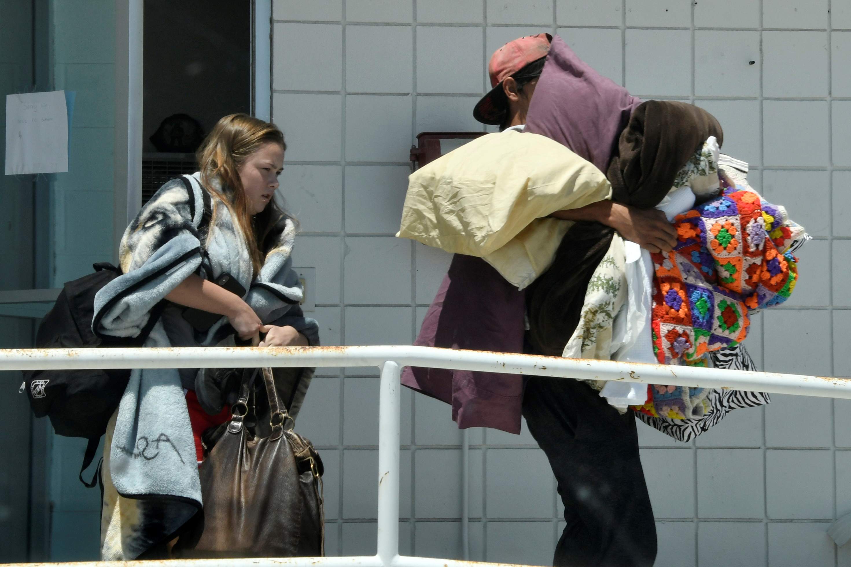
Nearly 60,000 people were displaced, many terrified by powerful aftershocks, and they needed tents, water and sanitary facilities, while the power utility was working to restore electricity, he said.

Commercial flights have yet to resume but military aircraft were taking people out of Palu. About 3,000 people thronged the small airport hoping to get out and officers struggled to keep order.

“I’d get a plane anywhere. I’ve been waiting for two days. Haven’t eaten, barely had a drink,” said 44-year-old food vendor Wiwid.

Indonesia is all too familiar with earthquakes and tsunamis. A quake in 2004 triggered a tsunami across the Indian Ocean that killed 226,000 people in 13 countries, including more than 120,000 in Indonesia.

Debris is seen after an earthquake in Palu, Indonesia September 30, 2018 in this picture obtained from social media. PALANG MERAH INDONESIA/via REUTERS

Debris is seen after an earthquake in Palu, Indonesia September 30, 2018 in this picture obtained from social media. PALANG MERAH INDONESIA/via REUTERS

Palu sits astride the Palu-Koro fault, which runs north-south along the edge of Palu Bay. Geologists estimate segments of the fault have a slip that is among the highest in Indonesia, at 4 cm (1.6 inches) a year, exposing the area to a higher risk of quakes.

Questions are sure to be asked why warning systems set up after the 2004 disaster appear to have failed.

Disaster agency spokesman Nugroho told reporters on Sunday none of Indonesia’s tsunami buoys, one device used to detect waves, had been operating since 2012. He blamed a lack of funds.

The meteorological and geophysics agency BMKG issued a tsunami warning after the quake but lifted it 34 minutes later, drawing criticism it had been too hasty.

However, officials estimated the waves had hit while the warning was in force.

(Additional reporting by Reuters stringer in PALU, Fergus Jensen, Fanny Potkin, Tabita Diela, Agustinus Beo Da Costa, Gayatri Suroyo and Fransiska Nangoy in JAKARTA; Writing by Robert Birsel; Editing by Paul Tait and Nick Macfie)

Indonesia relief efforts in Lombok stepped up as new quakes kill 10

Debris is seen on a road at Kayangan Port, after an earthquake hit Lombok, Indonesia, August 20, 2018, in this picture obtained from social media. Bayu Wiguna/via REUTERS

MATARAM, Indonesia (Reuters) – At least 10 people were killed by strong tremors that rocked Indonesia’s holiday island of Lombok on Sunday, authorities said following the latest in a series of earthquakes that killed hundreds and forced thousands to flee their homes in recent weeks.

Nearly 500 people have died in quakes and aftershocks since July 29 across the northern coast of the island, which lies just east of Indonesia’s top tourist destination, Bali.

Sutopo Purwo Nugroho, a spokesman at the national disaster mitigation agency, said on Monday relief and reconstruction efforts had been “intensified”.

“The rebuilding of public facilities like hospitals and schools is being speeded up,” he said.

He said more than 100 aftershocks had been recorded since Sunday night’s magnitude 6.9 quake, which sent panicked residents into the streets and cut power and communication lines across the island.

Aftershocks ranging between magnitude 4 and 5 were continuing on Monday morning and access to some areas had been cut off by landslides triggered by the tremors, according to officials in Mataram, Lombok’s main city.

Sunday’s quake came exactly a fortnight after another 6.9 magnitude earthquake which killed around 460 people and prompted massive search, rescue and relief efforts.

Authorities estimate that the Aug.5 earthquake caused 5 trillion rupiah ($342 million) of damage on Lombok.

Hundreds of thousands of residents have been left homeless and are camped out in open fields, refusing to shelter indoors due to continuing tremors.

Aid organizations like Save The Children said they were “ready to scale up their humanitarian response”.

“The population feels like it’s had the rug pulled from under them with this new quake,” said Caroline Haga, humanitarian & emergency communications specialist with the Red Cross.

(Additional reporting by Fanny Potkin and Kanupriya Kapoor; Writing by Kanupriya Kapoor; Editing by Ed Davies and Simon Cameron-Moore)

Death toll from Indonesia quake climbs over 320

An aerial view of the collapsed Jamiul Jamaah mosque where rescue workers and soldiers search for earthquake victims in Pemenang, North Lombok, Indonesia August 8, 2018 in this photo taken by Antara Foto. Antara Foto/Zabur Karuru/ via REUTERS

By Angie Teo

PEMANANG, Indonesia (Reuters) – The death toll from a huge 6.9 magnitude earthquake in Indonesia’s Lombok island has climbed to more than 320, officials said on Friday, even as relief efforts picked up pace.

The national disaster mitigation agency said it had verified 321 deaths and that over 270,000 people had been forced to flee their homes because of a series of tremors over the past two weeks.

On Thursday, the death toll from Sunday’s quake jumped to 259.

A fresh 5.9 magnitude aftershock prompted fresh panic in the north of the popular holiday destination on Thursday.

Nearly 75 percent of residential structures have been destroyed in northern Lombok because of poor construction unable to withstand strong tremors, the agency said in a statement.

“Aid is being distributed as quickly as possible upon arrival,” Sutopo Nugroho, spokesman for the agency said in a statement, adding that hundreds of volunteers were assisting the efforts.

Mobile kitchens have started distributing much-needed food and water to thousands of evacuees in the worst-hit areas, he said, after several days’ delay due to poor access and communications.

President Joko Widodo on Friday said he was delaying plans to visit Lombok until next week, citing concerns over continuing aftershocks.

“After the emergency period is over, the government will undertake rehabilitation, reconstruction, repairs to residential areas and public facilities,” the cabinet secretariat website quoted Widodo as saying.

Widodo visited the island after a 6.4 magnitude quake on July 29 killed 17 people and injured dozens more.

The quakes have prompted tourists to flee during what is otherwise the peak season for the island destination famous for its beaches.

(Additional reporting by Jessica Damiana in Jakarta; Writing by Kanupriya Kapoor; Editing by Alison Williams)

‘Go now’, Hawaii residents warned as eruptions spread

Lava advances along a street near a fissure in Leilani Estates, on Kilauea Volcano's lower East Rift Zone, Hawaii, the U.S., May 5, 2018. U.S. Geological Survey/Handout via REUTERS

By Terray Sylvester

PAHOA, Hawaii (Reuters) – Emergency authorities battling lava flows and gas erupting from Hawaii’s Kilauea volcano told some residents to “Go now” as a new fissure opened and more structures were destroyed.

Kilauea has destroyed 26 homes and forced 1,700 people to leave their residences since it erupted on Thursday, spewing lava and toxic gas from volcanic vents in a small area of Hawaii’s Big Island.

A new fissure spraying lava fountains as high as about 230 feet (70 m), according to United States Geological Survey, is shown from Luana Street in Leilani Estates subdivision on Kilauea Volcano's lower East Rift Zone in Hawaii, U.S., May 5, 2018. US Geological Survey/Handout via REUTERS

A new fissure spraying lava fountains as high as about 230 feet (70 m), according to United States Geological Survey, is shown from Luana Street in Leilani Estates subdivision on Kilauea Volcano’s lower East Rift Zone in Hawaii, U.S., May 5, 2018. US Geological Survey/Handout via REUTERS

A new fissure opened on Sunday night in the Leilani Estates area some 12 miles from the volcano, prompting a cellphone alert for residents to leave homes to avoid sulfur dioxide gas, which can be life threatening at high levels.So far no fatalities or major injuries have been reported from the volcano, according to the Hawaii County Civil Defense Agency.

Evacuees from Leilani Estates were allowed to return for pets, medications and to check property on Sunday, but some like Jeremy Wilson found homes surrounded by fissures that can be hundreds of feet long.

“My house is right in the middle,” said Wilson, who turned back in his car when he saw steam coming from cracks in the road ahead.

The semi-rural wooded area of Leilani Estates had become a magnet for newcomers to Hawaii’s Big Island who were prepared to risk living near to an active volcano in return for more affordable real-estate prices.

Eruptions of lava and gas were expected to continue, along with aftershocks from Friday’s 6.9 magnitude earthquake, the largest in the area since 1975, according to the Hawaiian Volcano Observatory. A lava flow advanced 0.6 of a mile from one of the vents.

Lava emerges from the ground after Kilauea Volcano erupted, on Hawaii's Big Island May 3, 2018, in this still image taken from video obtained from social media. Jeremiah Osuna/via REUTERS

Lava emerges from the ground after Kilauea Volcano erupted, on Hawaii’s Big Island May 3, 2018, in this still image taken from video obtained from social media. Jeremiah Osuna/via REUTERS

Geologists said the activity looked like an event in 1955 when eruptions continued for 88 days in the area and covered around 4,000 acres with lava.

Jessica Gauthier, 47, said she and other local realtors had seen vacation renters cancel their reservations, even though the volcanic activity is confined to a relatively isolated area far from tourist centers.

“There’s no way to know that if you’re sitting in your living room in Ohio and watching the national news,” she said.

Gauthier predicted business would pick up as a new kind of visitor began to appear.


County workers deliver cots and blankets to an evacuation center in Pahoa available to residents of the Puna communities of Leilani Estates and Lanipuna Gardens who were forced to leave their homes after the Kilauea Volcano erupted on Thursday in Hawaii, U.S., May 4, 2018. REUTERS/Terray Sylvester

County workers deliver cots and blankets to an evacuation center in Pahoa available to residents of the Puna communities of Leilani Estates and Lanipuna Gardens who were forced to leave their homes after the Kilauea Volcano erupted on Thursday in Hawaii, U.S., May 4, 2018. REUTERS/Terray Sylvester

“Within a month we’ll start getting lava tourists,” she said of people who come to Hawaii to see its active volcanoes.

Hawaii County authorities requested lava watchers keep away.

“This is not the time for sightseeing. You can help tremendously by staying out of the area,” the civil defense agency said in a statement.

(Reporting by Terray Sylvester; Writing by Andrew Hay in New Mexico; Editing by Hugh Lawson and Toby Chopra)